
VBMS Vicksburg, Mississippi - Earthquake Result Viewer
| ||||||||||||||||||
| ||||||||||||||||||
| ||||||||||||||||||
|
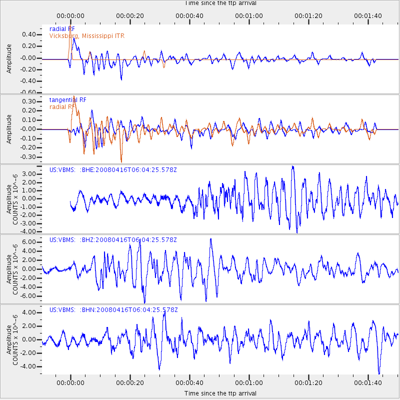
Signal To Noise
| Channel | StoN | STA | LTA |
| US:VBMS: :BHZ:20080416T06:04:25.578Z | 2.6850133 | 9.595435E-7 | 3.5737014E-7 |
| US:VBMS: :BHN:20080416T06:04:25.578Z | 1.3557059 | 6.2371896E-7 | 4.6006951E-7 |
| US:VBMS: :BHE:20080416T06:04:25.578Z | 0.7485451 | 4.3377267E-7 | 5.794877E-7 |
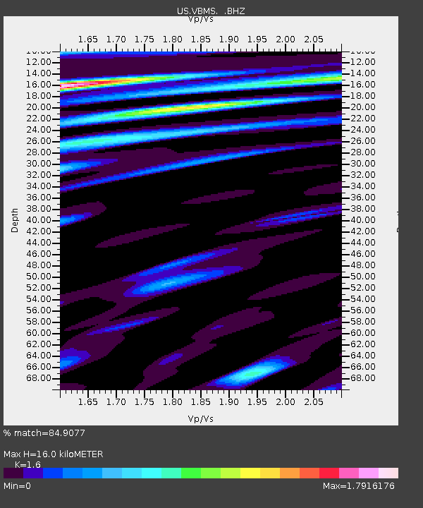
| Arrivals | |
| Ps | 1.6 SECOND |
| PpPs | 6.4 SECOND |
| PsPs/PpSs | 8.0 SECOND |

