You are here: Home > Network List > US - United States National Seismic Network Stations List
> Station VBMS Vicksburg, Mississippi > Earthquake Result Viewer
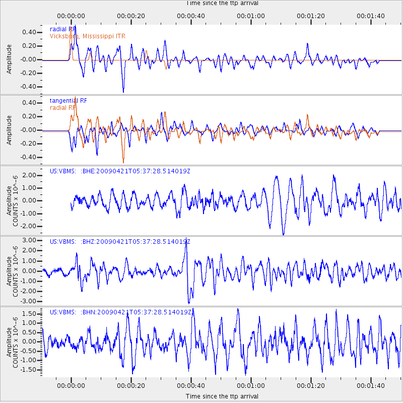
VBMS Vicksburg, Mississippi - Earthquake Result Viewer
*The percent match for this event was below the threshold and hence no stack was calculated.
| Earthquake location: |
Kuril Islands |
| Earthquake latitude/longitude: |
50.8/155.0 |
| Earthquake time(UTC): |
2009/04/21 (111) 05:26:11 GMT |
| Earthquake Depth: |
152 km |
| Earthquake Magnitude: |
6.0 MB, 6.2 MW, 6.2 MW |
| Earthquake Catalog/Contributor: |
WHDF/NEIC |
|
| Network: |
US United States National Seismic Network |
| Station: |
VBMS Vicksburg, Mississippi |
| Lat/Lon: |
32.22 N/90.52 W |
| Elevation: |
0.0 m |
|
| Distance: |
79.2 deg |
| Az: |
51.759 deg |
| Baz: |
324.014 deg |
| Ray Param: |
$rayparam |
*The percent match for this event was below the threshold and hence was not used in the summary stack. |
|
| Radial Match: |
76.32139 % |
| Radial Bump: |
400 |
| Transverse Match: |
64.20208 % |
| Transverse Bump: |
372 |
| SOD ConfigId: |
2760 |
| Insert Time: |
2010-03-05 06:33:08.931 +0000 |
| GWidth: |
2.5 |
| Max Bumps: |
400 |
| Tol: |
0.001 |
|
Signal To Noise
| Channel | StoN | STA | LTA |
| US:VBMS: :BHZ:20090421T05:37:28.514019Z | 5.3537226 | 8.5749275E-7 | 1.6016757E-7 |
| US:VBMS: :BHN:20090421T05:37:28.514019Z | 0.5497936 | 2.7662492E-7 | 5.031432E-7 |
| US:VBMS: :BHE:20090421T05:37:28.514019Z | 0.89529693 | 3.9678682E-7 | 4.4319017E-7 |
| Arrivals |
| Ps | |
| PpPs | |
| PsPs/PpSs | |


