You are here: Home > Network List > AV - Alaska Volcano Observatory Stations List
> Station AMKA Regional Station, Amchitka Island, Alaska > Earthquake Result Viewer
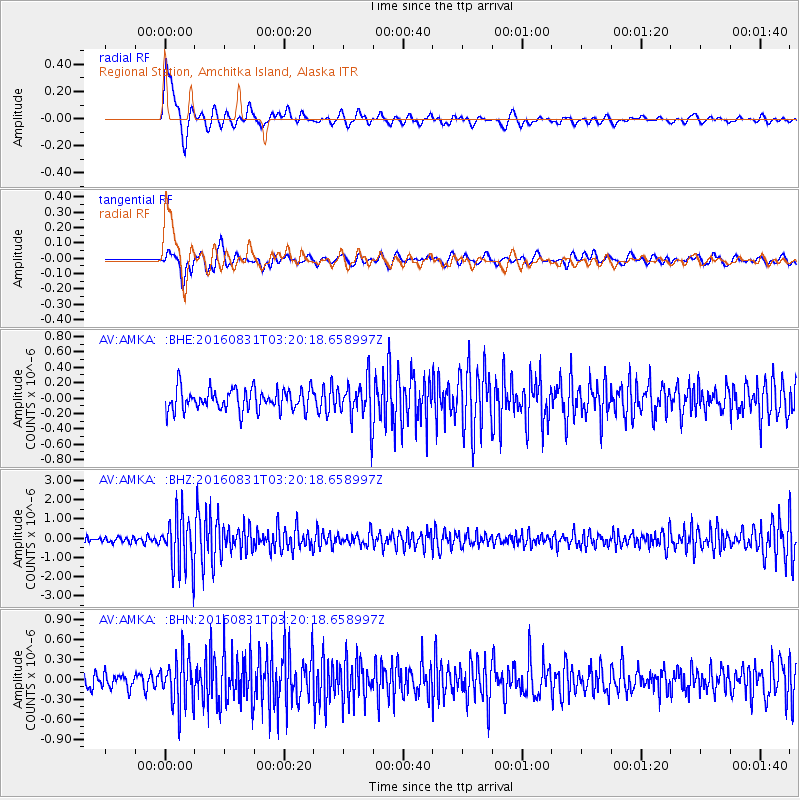
AMKA Regional Station, Amchitka Island, Alaska - Earthquake Result Viewer
*The percent match for this event was below the threshold and hence no stack was calculated.
| Earthquake location: |
New Ireland Region, P.N.G. |
| Earthquake latitude/longitude: |
-3.7/152.8 |
| Earthquake time(UTC): |
2016/08/31 (244) 03:11:36 GMT |
| Earthquake Depth: |
499 km |
| Earthquake Magnitude: |
6.7 MO |
| Earthquake Catalog/Contributor: |
NEIC PDE/NEIC ALERT |
|
| Network: |
AV Alaska Volcano Observatory |
| Station: |
AMKA Regional Station, Amchitka Island, Alaska |
| Lat/Lon: |
51.38 N/179.30 E |
| Elevation: |
116 m |
|
| Distance: |
59.3 deg |
| Az: |
18.979 deg |
| Baz: |
211.189 deg |
| Ray Param: |
$rayparam |
*The percent match for this event was below the threshold and hence was not used in the summary stack. |
|
| Radial Match: |
67.51013 % |
| Radial Bump: |
400 |
| Transverse Match: |
58.200077 % |
| Transverse Bump: |
400 |
| SOD ConfigId: |
11737051 |
| Insert Time: |
2019-04-25 09:38:29.187 +0000 |
| GWidth: |
2.5 |
| Max Bumps: |
400 |
| Tol: |
0.001 |
|
Signal To Noise
| Channel | StoN | STA | LTA |
| AV:AMKA: :BHZ:20160831T03:20:18.658997Z | 10.181289 | 1.4189272E-6 | 1.3936616E-7 |
| AV:AMKA: :BHN:20160831T03:20:18.658997Z | 3.484809 | 3.6857242E-7 | 1.0576546E-7 |
| AV:AMKA: :BHE:20160831T03:20:18.658997Z | 1.9612672 | 2.7718306E-7 | 1.4132857E-7 |
| Arrivals |
| Ps | |
| PpPs | |
| PsPs/PpSs | |


