You are here: Home > Network List > CI - Caltech Regional Seismic Network Stations List
> Station MPP McPhearson Peak > Earthquake Result Viewer
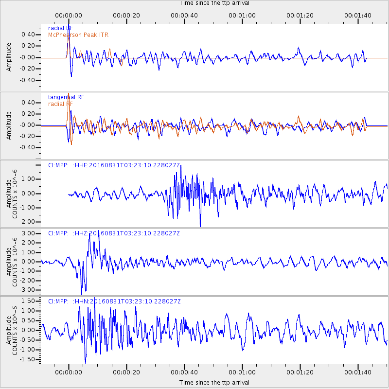
MPP McPhearson Peak - Earthquake Result Viewer
*The percent match for this event was below the threshold and hence no stack was calculated.
| Earthquake location: |
New Ireland Region, P.N.G. |
| Earthquake latitude/longitude: |
-3.7/152.8 |
| Earthquake time(UTC): |
2016/08/31 (244) 03:11:36 GMT |
| Earthquake Depth: |
499 km |
| Earthquake Magnitude: |
6.7 MO |
| Earthquake Catalog/Contributor: |
NEIC PDE/NEIC ALERT |
|
| Network: |
CI Caltech Regional Seismic Network |
| Station: |
MPP McPhearson Peak |
| Lat/Lon: |
34.89 N/119.81 W |
| Elevation: |
1739 m |
|
| Distance: |
90.0 deg |
| Az: |
55.207 deg |
| Baz: |
265.505 deg |
| Ray Param: |
$rayparam |
*The percent match for this event was below the threshold and hence was not used in the summary stack. |
|
| Radial Match: |
68.49952 % |
| Radial Bump: |
400 |
| Transverse Match: |
57.558678 % |
| Transverse Bump: |
400 |
| SOD ConfigId: |
11737051 |
| Insert Time: |
2019-04-25 09:40:19.770 +0000 |
| GWidth: |
2.5 |
| Max Bumps: |
400 |
| Tol: |
0.001 |
|
Signal To Noise
| Channel | StoN | STA | LTA |
| CI:MPP: :HHZ:20160831T03:23:10.228027Z | 6.220439 | 1.0738377E-6 | 1.7263052E-7 |
| CI:MPP: :HHN:20160831T03:23:10.228027Z | 1.8017154 | 4.481166E-7 | 2.4871665E-7 |
| CI:MPP: :HHE:20160831T03:23:10.228027Z | 2.007731 | 4.2709274E-7 | 2.127241E-7 |
| Arrivals |
| Ps | |
| PpPs | |
| PsPs/PpSs | |


