You are here: Home > Network List > UW - Pacific Northwest Regional Seismic Network Stations List
> Station FISH Seaside, OR, USA > Earthquake Result Viewer
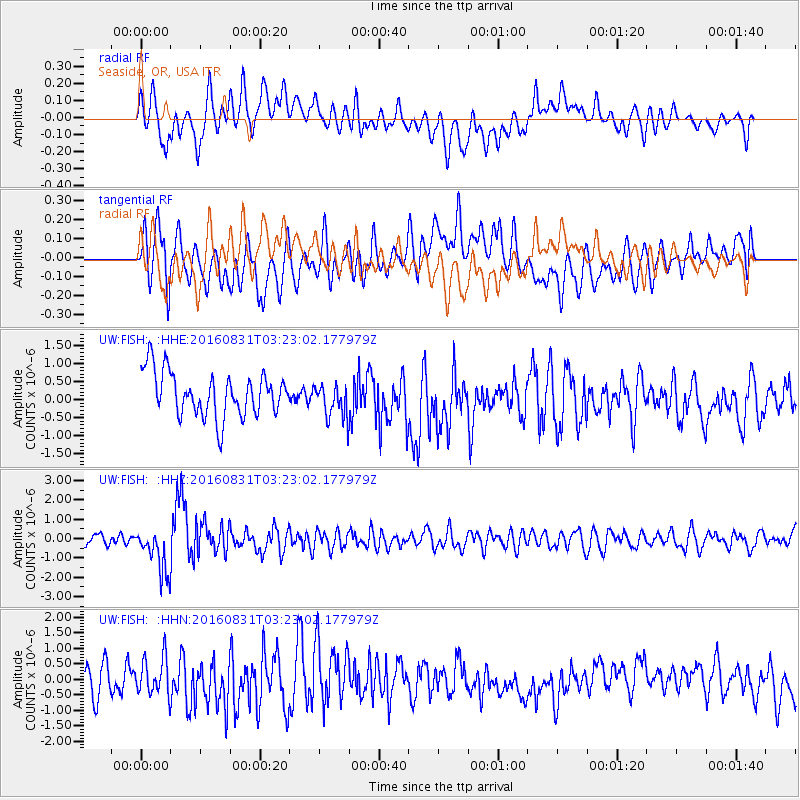
FISH Seaside, OR, USA - Earthquake Result Viewer
*The percent match for this event was below the threshold and hence no stack was calculated.
| Earthquake location: |
New Ireland Region, P.N.G. |
| Earthquake latitude/longitude: |
-3.7/152.8 |
| Earthquake time(UTC): |
2016/08/31 (244) 03:11:36 GMT |
| Earthquake Depth: |
499 km |
| Earthquake Magnitude: |
6.7 MO |
| Earthquake Catalog/Contributor: |
NEIC PDE/NEIC ALERT |
|
| Network: |
UW Pacific Northwest Regional Seismic Network |
| Station: |
FISH Seaside, OR, USA |
| Lat/Lon: |
45.93 N/123.56 W |
| Elevation: |
325 m |
|
| Distance: |
88.2 deg |
| Az: |
43.947 deg |
| Baz: |
262.894 deg |
| Ray Param: |
$rayparam |
*The percent match for this event was below the threshold and hence was not used in the summary stack. |
|
| Radial Match: |
51.621952 % |
| Radial Bump: |
400 |
| Transverse Match: |
51.490227 % |
| Transverse Bump: |
400 |
| SOD ConfigId: |
11737051 |
| Insert Time: |
2019-04-25 09:46:05.854 +0000 |
| GWidth: |
2.5 |
| Max Bumps: |
400 |
| Tol: |
0.001 |
|
Signal To Noise
| Channel | StoN | STA | LTA |
| UW:FISH: :HHZ:20160831T03:23:02.177979Z | 4.2441416 | 1.1632586E-6 | 2.7408572E-7 |
| UW:FISH: :HHN:20160831T03:23:02.177979Z | 0.7418814 | 5.954073E-7 | 8.02564E-7 |
| UW:FISH: :HHE:20160831T03:23:02.177979Z | 0.7688366 | 4.6888846E-7 | 6.0986747E-7 |
| Arrivals |
| Ps | |
| PpPs | |
| PsPs/PpSs | |


