You are here: Home > Network List > US - United States National Seismic Network Stations List
> Station WCI Wyandotte Cave, Indiana, USA > Earthquake Result Viewer
WCI Wyandotte Cave, Indiana, USA - Earthquake Result Viewer

| Earthquake location: |
Kuril Islands |
| Earthquake latitude/longitude: |
50.0/156.2 |
| Earthquake time(UTC): |
2002/12/24 (358) 14:43:07 GMT |
| Earthquake Depth: |
67 km |
| Earthquake Magnitude: |
5.5 MB, 5.5 MW, 5.4 MW |
| Earthquake Catalog/Contributor: |
WHDF/NEIC |
|
| Network: |
US United States National Seismic Network |
| Station: |
WCI Wyandotte Cave, Indiana, USA |
| Lat/Lon: |
38.23 N/86.29 W |
| Elevation: |
500 m |
|
| Distance: |
76.4 deg |
| Az: |
45.937 deg |
| Baz: |
323.935 deg |
| Ray Param: |
0.0509074 |
| Estimated Moho Depth: |
10.0 km |
| Estimated Crust Vp/Vs: |
1.60 |
| Assumed Crust Vp: |
6.444 km/s |
| Estimated Crust Vs: |
4.027 km/s |
| Estimated Crust Poisson's Ratio: |
0.18 |
|
| Radial Match: |
99.20764 % |
| Radial Bump: |
44 |
| Transverse Match: |
99.941376 % |
| Transverse Bump: |
13 |
| SOD ConfigId: |
110165 |
| Insert Time: |
2010-03-05 06:35:19.563 +0000 |
| GWidth: |
2.5 |
| Max Bumps: |
400 |
| Tol: |
0.001 |
|
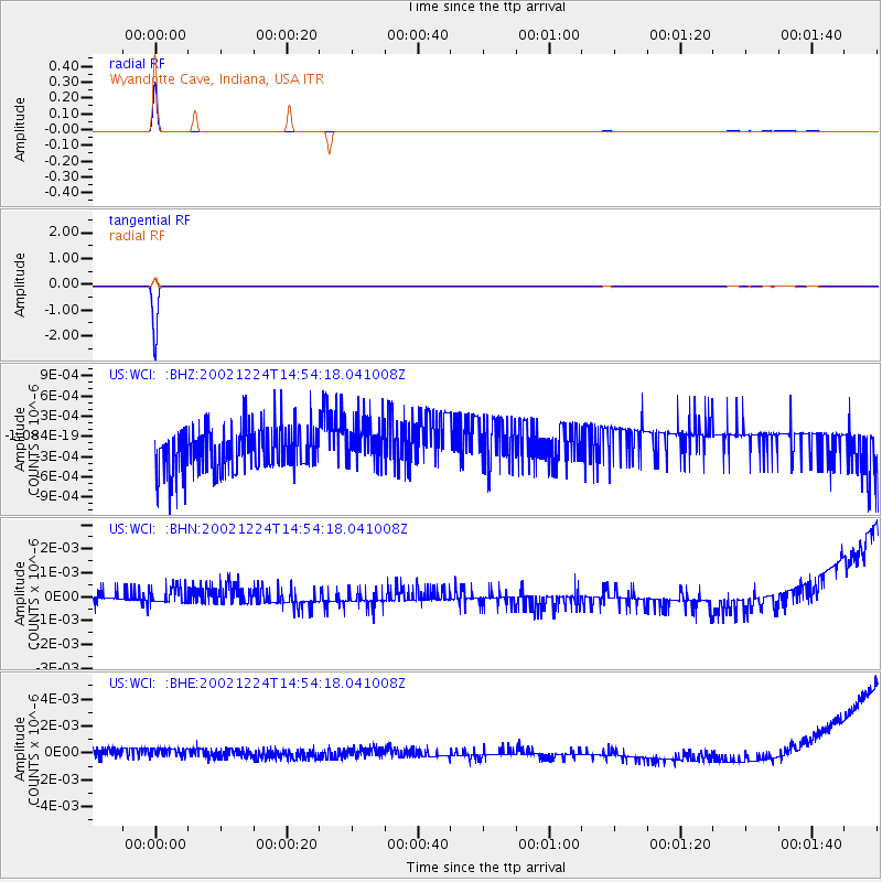
Signal To Noise
| Channel | StoN | STA | LTA |
| US:WCI: :BHN:20021224T14:54:18.041008Z | 1.3211648 | 4.6859044E-10 | 3.5467979E-10 |
| US:WCI: :BHE:20021224T14:54:18.041008Z | 1.1809092 | 6.390614E-10 | 5.411605E-10 |
| US:WCI: :BHZ:20021224T14:54:18.041008Z | 0.9696076 | 3.2610187E-10 | 3.3632355E-10 |
| Arrivals |
| Ps | 1.0 SECOND |
| PpPs | 3.9 SECOND |
| PsPs/PpSs | 4.9 SECOND |


