You are here: Home > Network List > AV - Alaska Volcano Observatory Stations List
> Station MAPS Pakushin Southeast, Makushin Volcano, Alaska > Earthquake Result Viewer
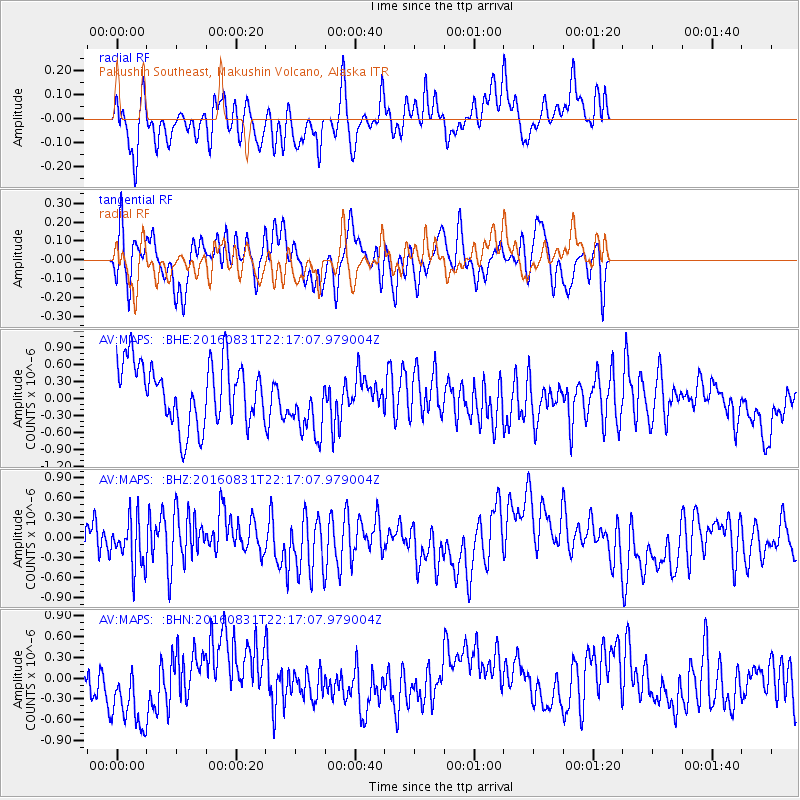
MAPS Pakushin Southeast, Makushin Volcano, Alaska - Earthquake Result Viewer
*The percent match for this event was below the threshold and hence no stack was calculated.
| Earthquake location: |
Off E. Coast Of N. Island, N.Z. |
| Earthquake latitude/longitude: |
-37.2/179.1 |
| Earthquake time(UTC): |
2016/08/31 (244) 22:04:35 GMT |
| Earthquake Depth: |
22 km |
| Earthquake Magnitude: |
5.8 MB |
| Earthquake Catalog/Contributor: |
NEIC PDE/NEIC ALERT |
|
| Network: |
AV Alaska Volcano Observatory |
| Station: |
MAPS Pakushin Southeast, Makushin Volcano, Alaska |
| Lat/Lon: |
53.81 N/166.94 W |
| Elevation: |
333 m |
|
| Distance: |
91.4 deg |
| Az: |
8.214 deg |
| Baz: |
191.088 deg |
| Ray Param: |
$rayparam |
*The percent match for this event was below the threshold and hence was not used in the summary stack. |
|
| Radial Match: |
43.77897 % |
| Radial Bump: |
385 |
| Transverse Match: |
55.638474 % |
| Transverse Bump: |
400 |
| SOD ConfigId: |
11737051 |
| Insert Time: |
2019-04-25 09:48:47.423 +0000 |
| GWidth: |
2.5 |
| Max Bumps: |
400 |
| Tol: |
0.001 |
|
Signal To Noise
| Channel | StoN | STA | LTA |
| AV:MAPS: :BHZ:20160831T22:17:07.979004Z | 0.77581835 | 3.5423196E-7 | 4.5659138E-7 |
| AV:MAPS: :BHN:20160831T22:17:07.979004Z | 1.5606319 | 5.4678907E-7 | 3.5036388E-7 |
| AV:MAPS: :BHE:20160831T22:17:07.979004Z | 1.0860511 | 5.8965304E-7 | 5.4293304E-7 |
| Arrivals |
| Ps | |
| PpPs | |
| PsPs/PpSs | |


