You are here: Home > Network List > TA - USArray Transportable Network (new EarthScope stations) Stations List
> Station R11A Troy Canyon, Currant, NV, USA > Earthquake Result Viewer
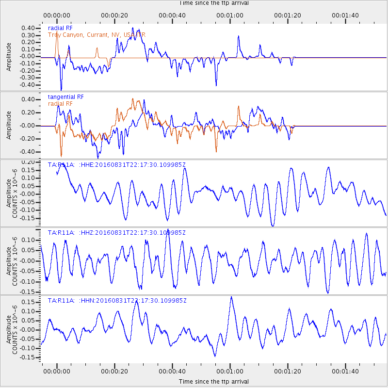
R11A Troy Canyon, Currant, NV, USA - Earthquake Result Viewer
*The percent match for this event was below the threshold and hence no stack was calculated.
| Earthquake location: |
Off E. Coast Of N. Island, N.Z. |
| Earthquake latitude/longitude: |
-37.2/179.1 |
| Earthquake time(UTC): |
2016/08/31 (244) 22:04:35 GMT |
| Earthquake Depth: |
22 km |
| Earthquake Magnitude: |
5.8 MB |
| Earthquake Catalog/Contributor: |
NEIC PDE/NEIC ALERT |
|
| Network: |
TA USArray Transportable Network (new EarthScope stations) |
| Station: |
R11A Troy Canyon, Currant, NV, USA |
| Lat/Lon: |
38.35 N/115.59 W |
| Elevation: |
1756 m |
|
| Distance: |
96.3 deg |
| Az: |
45.939 deg |
| Baz: |
226.86 deg |
| Ray Param: |
$rayparam |
*The percent match for this event was below the threshold and hence was not used in the summary stack. |
|
| Radial Match: |
53.140438 % |
| Radial Bump: |
400 |
| Transverse Match: |
53.11229 % |
| Transverse Bump: |
400 |
| SOD ConfigId: |
11737051 |
| Insert Time: |
2019-04-25 09:51:06.849 +0000 |
| GWidth: |
2.5 |
| Max Bumps: |
400 |
| Tol: |
0.001 |
|
Signal To Noise
| Channel | StoN | STA | LTA |
| TA:R11A: :HHZ:20160831T22:17:30.109985Z | 1.1723735 | 6.816957E-8 | 5.8146625E-8 |
| TA:R11A: :HHN:20160831T22:17:30.109985Z | 0.4341777 | 2.1363542E-8 | 4.9204605E-8 |
| TA:R11A: :HHE:20160831T22:17:30.109985Z | 0.923518 | 7.445535E-8 | 8.062143E-8 |
| Arrivals |
| Ps | |
| PpPs | |
| PsPs/PpSs | |


