WCI Wyandotte Cave, Indiana, USA - Earthquake Result Viewer
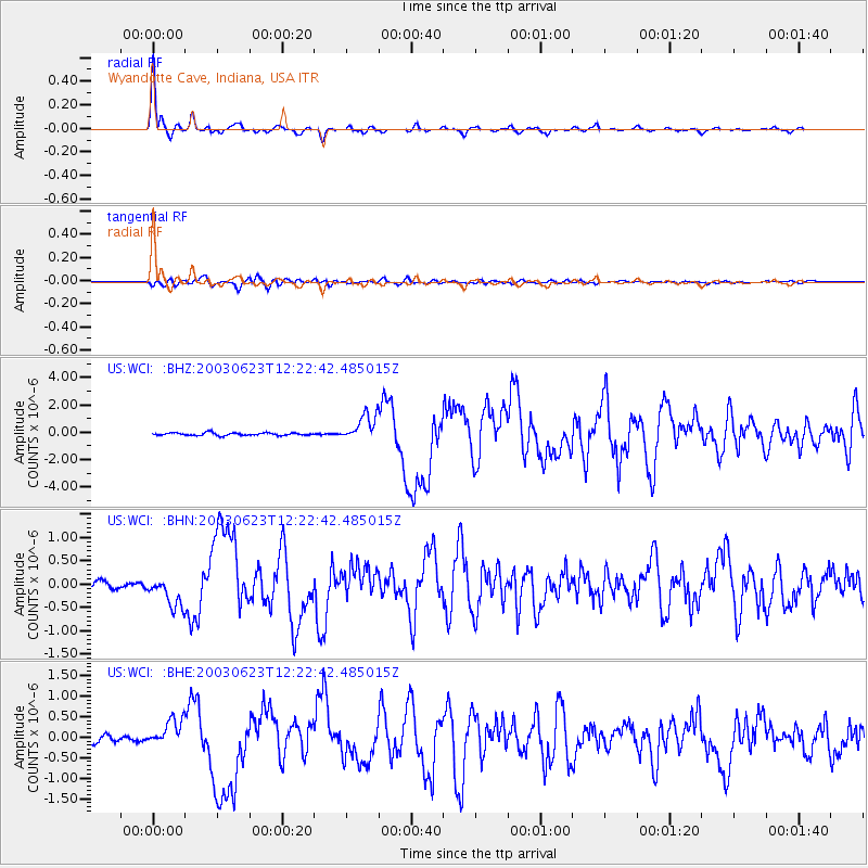
Earthquake location: Rat Islands, Aleutian Islands
Earthquake latitude/longitude: 51.4/176.8
Earthquake time(UTC): 2003/06/23 (174) 12:12:34 GMT
Earthquake Depth: 20 km
Earthquake Magnitude: 6.3 MB, 7.0 MS, 6.9 MW, 6.8 MW
Earthquake Catalog/Contributor: WHDF/NEIC
Network: US United States National Seismic Network
Station: WCI Wyandotte Cave, Indiana, USA
Lat/Lon: 38.23 N/86.29 W
Elevation: 500 m
Distance: 65.1 deg
Az: 59.542 deg
Baz: 316.759 deg
Ray Param: 0.058478713
Estimated Moho Depth: 48.25 km
Estimated Crust Vp/Vs: 1.80
Assumed Crust Vp: 6.444 km/s
Estimated Crust Vs: 3.575 km/s
Estimated Crust Poisson's Ratio: 0.28
Radial Match: 96.99552 %
Radial Bump: 322
Transverse Match: 87.145905 %
Transverse Bump: 400
SOD ConfigId: 110177
Insert Time: 2010-03-05 06:36:00.010 +0000
GWidth: 2.5
Max Bumps: 400
Tol: 0.001

Signal To Noise

ChannelStoNSTALTA
US:WCI: :BHN:20030623T12:22:42.485015Z3.21182543.220316E-71.0026436E-7
US:WCI: :BHE:20030623T12:22:42.485015Z3.5466423.282534E-79.25533E-8
US:WCI: :BHZ:20030623T12:22:42.485015Z9.7492029.526202E-79.7712636E-8
Arrivals
Ps6.3 SECOND
PpPs20 SECOND
PsPs/PpSs26 SECOND