You are here: Home > Network List > UW - Pacific Northwest Regional Seismic Network Stations List
> Station LEBA Lebam, WA, USA > Earthquake Result Viewer
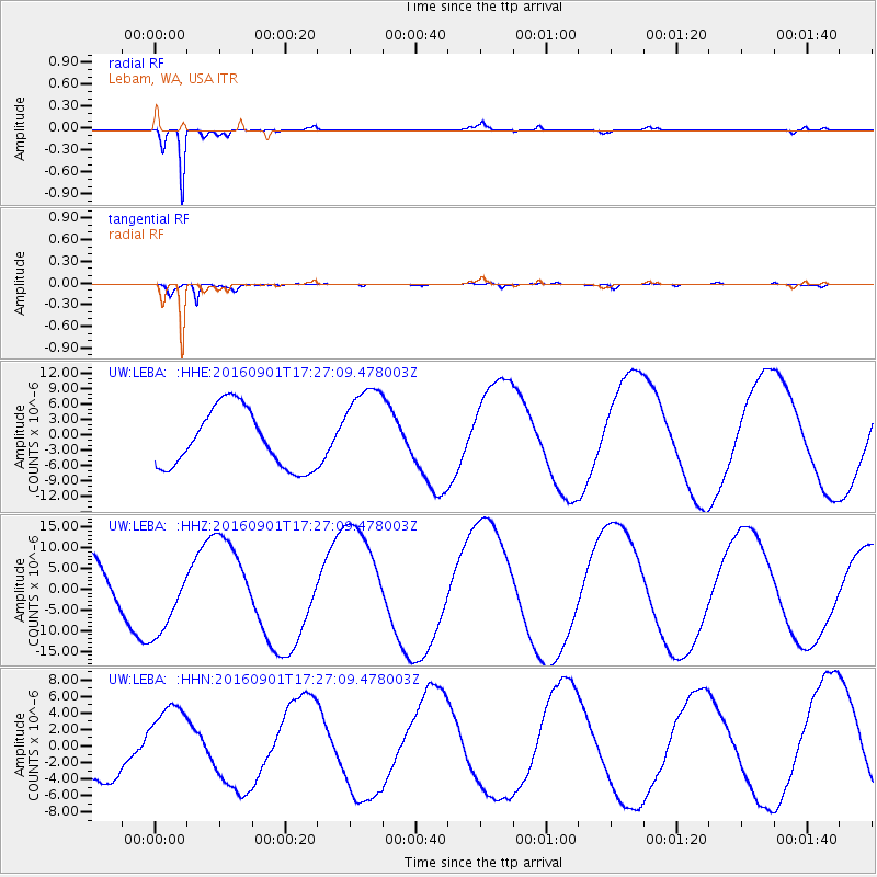
LEBA Lebam, WA, USA - Earthquake Result Viewer
*The percent match for this event was below the threshold and hence no stack was calculated.
| Earthquake location: |
Off E. Coast Of N. Island, N.Z. |
| Earthquake latitude/longitude: |
-37.0/179.0 |
| Earthquake time(UTC): |
2016/09/01 (245) 17:14:05 GMT |
| Earthquake Depth: |
14 km |
| Earthquake Magnitude: |
5.7 MB |
| Earthquake Catalog/Contributor: |
NEIC PDE/NEIC COMCAT |
|
| Network: |
UW Pacific Northwest Regional Seismic Network |
| Station: |
LEBA Lebam, WA, USA |
| Lat/Lon: |
46.55 N/123.56 W |
| Elevation: |
73 m |
|
| Distance: |
97.9 deg |
| Az: |
35.957 deg |
| Baz: |
222.897 deg |
| Ray Param: |
$rayparam |
*The percent match for this event was below the threshold and hence was not used in the summary stack. |
|
| Radial Match: |
97.63479 % |
| Radial Bump: |
237 |
| Transverse Match: |
89.99419 % |
| Transverse Bump: |
400 |
| SOD ConfigId: |
11737051 |
| Insert Time: |
2019-04-25 10:10:17.907 +0000 |
| GWidth: |
2.5 |
| Max Bumps: |
400 |
| Tol: |
0.001 |
|
Signal To Noise
| Channel | StoN | STA | LTA |
| UW:LEBA: :HHZ:20160901T17:27:09.478003Z | 1.4585344 | 9.249763E-6 | 6.3418206E-6 |
| UW:LEBA: :HHN:20160901T17:27:09.478003Z | 1.9091575 | 4.816963E-6 | 2.5230831E-6 |
| UW:LEBA: :HHE:20160901T17:27:09.478003Z | 1.5100198 | 8.576189E-6 | 5.679521E-6 |
| Arrivals |
| Ps | |
| PpPs | |
| PsPs/PpSs | |


