You are here: Home > Network List > TA - USArray Transportable Network (new EarthScope stations) Stations List
> Station A21K Barrow, AK, USA > Earthquake Result Viewer
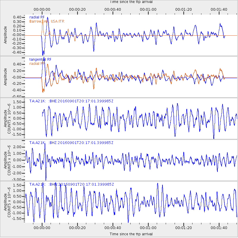
A21K Barrow, AK, USA - Earthquake Result Viewer
*The percent match for this event was below the threshold and hence no stack was calculated.
| Earthquake location: |
Northern Sumatra, Indonesia |
| Earthquake latitude/longitude: |
0.6/98.5 |
| Earthquake time(UTC): |
2016/09/01 (245) 20:04:15 GMT |
| Earthquake Depth: |
24 km |
| Earthquake Magnitude: |
5.8 MB |
| Earthquake Catalog/Contributor: |
NEIC PDE/NEIC COMCAT |
|
| Network: |
TA USArray Transportable Network (new EarthScope stations) |
| Station: |
A21K Barrow, AK, USA |
| Lat/Lon: |
71.32 N/156.62 W |
| Elevation: |
577 m |
|
| Distance: |
94.2 deg |
| Az: |
18.195 deg |
| Baz: |
284.27 deg |
| Ray Param: |
$rayparam |
*The percent match for this event was below the threshold and hence was not used in the summary stack. |
|
| Radial Match: |
56.981033 % |
| Radial Bump: |
400 |
| Transverse Match: |
54.968433 % |
| Transverse Bump: |
400 |
| SOD ConfigId: |
11737051 |
| Insert Time: |
2019-04-25 10:20:34.760 +0000 |
| GWidth: |
2.5 |
| Max Bumps: |
400 |
| Tol: |
0.001 |
|
Signal To Noise
| Channel | StoN | STA | LTA |
| TA:A21K: :BHZ:20160901T20:17:01.399985Z | 1.8689061 | 1.1224608E-6 | 6.005978E-7 |
| TA:A21K: :BHN:20160901T20:17:01.399985Z | 2.0330124 | 8.5581854E-7 | 4.2096082E-7 |
| TA:A21K: :BHE:20160901T20:17:01.399985Z | 0.9860876 | 6.188354E-7 | 6.275663E-7 |
| Arrivals |
| Ps | |
| PpPs | |
| PsPs/PpSs | |


