You are here: Home > Network List > TA - USArray Transportable Network (new EarthScope stations) Stations List
> Station G21K Allakaket, AK, USA > Earthquake Result Viewer
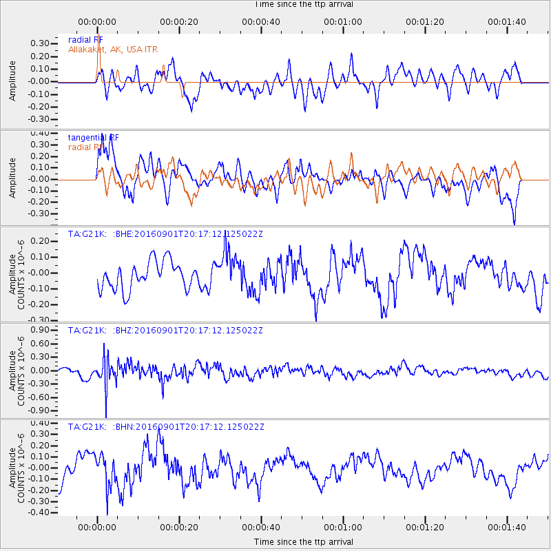
G21K Allakaket, AK, USA - Earthquake Result Viewer
*The percent match for this event was below the threshold and hence no stack was calculated.
| Earthquake location: |
Northern Sumatra, Indonesia |
| Earthquake latitude/longitude: |
0.6/98.5 |
| Earthquake time(UTC): |
2016/09/01 (245) 20:04:15 GMT |
| Earthquake Depth: |
24 km |
| Earthquake Magnitude: |
5.8 MB |
| Earthquake Catalog/Contributor: |
NEIC PDE/NEIC COMCAT |
|
| Network: |
TA USArray Transportable Network (new EarthScope stations) |
| Station: |
G21K Allakaket, AK, USA |
| Lat/Lon: |
66.52 N/153.51 W |
| Elevation: |
446 m |
|
| Distance: |
96.6 deg |
| Az: |
22.566 deg |
| Baz: |
286.763 deg |
| Ray Param: |
$rayparam |
*The percent match for this event was below the threshold and hence was not used in the summary stack. |
|
| Radial Match: |
54.299072 % |
| Radial Bump: |
400 |
| Transverse Match: |
68.147064 % |
| Transverse Bump: |
400 |
| SOD ConfigId: |
11737051 |
| Insert Time: |
2019-04-25 10:20:37.618 +0000 |
| GWidth: |
2.5 |
| Max Bumps: |
400 |
| Tol: |
0.001 |
|
Signal To Noise
| Channel | StoN | STA | LTA |
| TA:G21K: :BHZ:20160901T20:17:12.125022Z | 2.42411 | 2.9228562E-7 | 1.2057441E-7 |
| TA:G21K: :BHN:20160901T20:17:12.125022Z | 1.1776949 | 1.416847E-7 | 1.2030678E-7 |
| TA:G21K: :BHE:20160901T20:17:12.125022Z | 1.4032139 | 1.2059063E-7 | 8.593887E-8 |
| Arrivals |
| Ps | |
| PpPs | |
| PsPs/PpSs | |


