You are here: Home > Network List > GS - US Geological Survey Networks Stations List
> Station KAN10 Keim Farm, Anthony, KS, USA > Earthquake Result Viewer
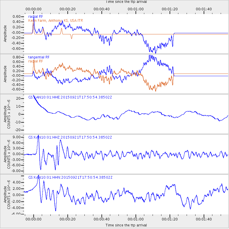
KAN10 Keim Farm, Anthony, KS, USA - Earthquake Result Viewer
*The percent match for this event was below the threshold and hence no stack was calculated.
| Earthquake location: |
Near Coast Of Central Chile |
| Earthquake latitude/longitude: |
-31.7/-71.6 |
| Earthquake time(UTC): |
2015/09/21 (264) 17:39:58 GMT |
| Earthquake Depth: |
25 km |
| Earthquake Magnitude: |
6.5 MB, 6.5 MI, 6.6 MWW |
| Earthquake Catalog/Contributor: |
NEIC PDE/NEIC COMCAT |
|
| Network: |
GS US Geological Survey Networks |
| Station: |
KAN10 Keim Farm, Anthony, KS, USA |
| Lat/Lon: |
37.12 N/98.10 W |
| Elevation: |
417 m |
|
| Distance: |
72.8 deg |
| Az: |
338.116 deg |
| Baz: |
156.59 deg |
| Ray Param: |
$rayparam |
*The percent match for this event was below the threshold and hence was not used in the summary stack. |
|
| Radial Match: |
32.563915 % |
| Radial Bump: |
400 |
| Transverse Match: |
32.48971 % |
| Transverse Bump: |
400 |
| SOD ConfigId: |
1156111 |
| Insert Time: |
2015-10-05 17:51:55.741 +0000 |
| GWidth: |
2.5 |
| Max Bumps: |
400 |
| Tol: |
0.001 |
|
Signal To Noise
| Channel | StoN | STA | LTA |
| GS:KAN10:01:HHZ:20150921T17:50:54.38502Z | 19.61045 | 4.677258E-6 | 2.3850842E-7 |
| GS:KAN10:01:HHN:20150921T17:50:54.38502Z | 1.8448024 | 4.7290573E-6 | 2.5634492E-6 |
| GS:KAN10:01:HHE:20150921T17:50:54.38502Z | 1.5203677 | 1.0294232E-5 | 6.770883E-6 |
| Arrivals |
| Ps | |
| PpPs | |
| PsPs/PpSs | |


