You are here: Home > Network List > CI - Caltech Regional Seismic Network Stations List
> Station SMM Simmler, CA, USA > Earthquake Result Viewer
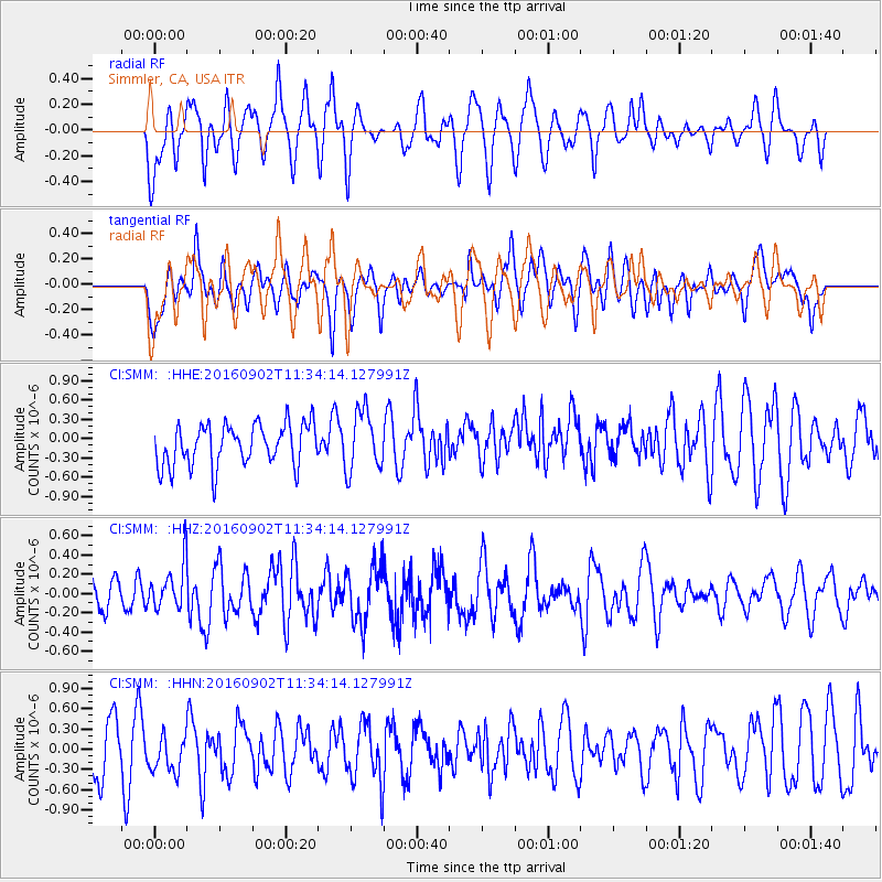
SMM Simmler, CA, USA - Earthquake Result Viewer
*The percent match for this event was below the threshold and hence no stack was calculated.
| Earthquake location: |
Tonga Islands |
| Earthquake latitude/longitude: |
-19.6/-173.6 |
| Earthquake time(UTC): |
2016/09/02 (246) 11:23:07 GMT |
| Earthquake Depth: |
10 km |
| Earthquake Magnitude: |
5.5 MB |
| Earthquake Catalog/Contributor: |
NEIC PDE/NEIC ALERT |
|
| Network: |
CI Caltech Regional Seismic Network |
| Station: |
SMM Simmler, CA, USA |
| Lat/Lon: |
35.31 N/120.00 W |
| Elevation: |
599 m |
|
| Distance: |
74.6 deg |
| Az: |
43.074 deg |
| Baz: |
231.938 deg |
| Ray Param: |
$rayparam |
*The percent match for this event was below the threshold and hence was not used in the summary stack. |
|
| Radial Match: |
56.533573 % |
| Radial Bump: |
400 |
| Transverse Match: |
48.876965 % |
| Transverse Bump: |
400 |
| SOD ConfigId: |
11737051 |
| Insert Time: |
2019-04-25 10:30:53.796 +0000 |
| GWidth: |
2.5 |
| Max Bumps: |
400 |
| Tol: |
0.001 |
|
Signal To Noise
| Channel | StoN | STA | LTA |
| CI:SMM: :HHZ:20160902T11:34:14.127991Z | 1.1828392 | 2.4114738E-7 | 2.0387166E-7 |
| CI:SMM: :HHN:20160902T11:34:14.127991Z | 0.7560375 | 3.013371E-7 | 3.9857431E-7 |
| CI:SMM: :HHE:20160902T11:34:14.127991Z | 1.3955458 | 4.4751363E-7 | 3.2067283E-7 |
| Arrivals |
| Ps | |
| PpPs | |
| PsPs/PpSs | |


