You are here: Home > Network List > TA - USArray Transportable Network (new EarthScope stations) Stations List
> Station J20K Nowitna River, AK, USA > Earthquake Result Viewer
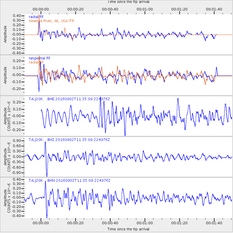
J20K Nowitna River, AK, USA - Earthquake Result Viewer
*The percent match for this event was below the threshold and hence no stack was calculated.
| Earthquake location: |
Tonga Islands |
| Earthquake latitude/longitude: |
-19.6/-173.6 |
| Earthquake time(UTC): |
2016/09/02 (246) 11:23:07 GMT |
| Earthquake Depth: |
10 km |
| Earthquake Magnitude: |
5.5 MB |
| Earthquake Catalog/Contributor: |
NEIC PDE/NEIC ALERT |
|
| Network: |
TA USArray Transportable Network (new EarthScope stations) |
| Station: |
J20K Nowitna River, AK, USA |
| Lat/Lon: |
64.18 N/154.15 W |
| Elevation: |
314 m |
|
| Distance: |
84.9 deg |
| Az: |
8.427 deg |
| Baz: |
198.391 deg |
| Ray Param: |
$rayparam |
*The percent match for this event was below the threshold and hence was not used in the summary stack. |
|
| Radial Match: |
60.353596 % |
| Radial Bump: |
400 |
| Transverse Match: |
59.824116 % |
| Transverse Bump: |
400 |
| SOD ConfigId: |
11737051 |
| Insert Time: |
2019-04-25 10:34:37.833 +0000 |
| GWidth: |
2.5 |
| Max Bumps: |
400 |
| Tol: |
0.001 |
|
Signal To Noise
| Channel | StoN | STA | LTA |
| TA:J20K: :BHZ:20160902T11:35:09.224976Z | 5.506381 | 4.3021114E-7 | 7.812957E-8 |
| TA:J20K: :BHN:20160902T11:35:09.224976Z | 2.8689096 | 1.769321E-7 | 6.1672246E-8 |
| TA:J20K: :BHE:20160902T11:35:09.224976Z | 1.46239 | 1.0634185E-7 | 7.271785E-8 |
| Arrivals |
| Ps | |
| PpPs | |
| PsPs/PpSs | |


