MYNC Murphy, North Carolina, USA - Earthquake Result Viewer
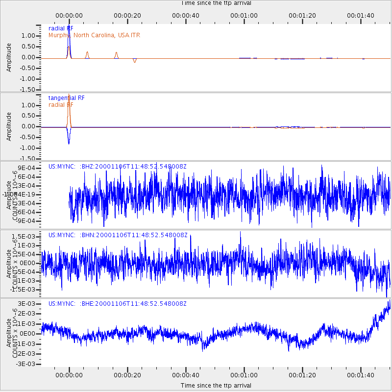
Earthquake location: Kodiak Island Region, Alaska
Earthquake latitude/longitude: 56.2/-153.5
Earthquake time(UTC): 2000/11/06 (311) 11:40:26 GMT
Earthquake Depth: 20 km
Earthquake Magnitude: 5.5 MB, 5.6 MS, 6.0 MW, 5.5 ML
Earthquake Catalog/Contributor: WHDF/NEIC
Network: US United States National Seismic Network
Station: MYNC Murphy, North Carolina, USA
Lat/Lon: 35.07 N/84.13 W
Elevation: 550 m
Distance: 50.5 deg
Az: 84.038 deg
Baz: 317.268 deg
Ray Param: 0.06799184
Estimated Moho Depth: 24.0 km
Estimated Crust Vp/Vs: 1.77
Assumed Crust Vp: 6.35 km/s
Estimated Crust Vs: 3.588 km/s
Estimated Crust Poisson's Ratio: 0.27
Radial Match: 98.82726 %
Radial Bump: 47
Transverse Match: 96.581726 %
Transverse Bump: 55
SOD ConfigId: 110165
Insert Time: 2010-03-05 06:38:49.144 +0000
GWidth: 2.5
Max Bumps: 400
Tol: 0.001

Signal To Noise

ChannelStoNSTALTA
US:MYNC: :BHN:20001106T11:48:52.548008Z1.196314.708432E-103.9357956E-10
US:MYNC: :BHE:20001106T11:48:52.548008Z0.546148243.7806377E-106.9223655E-10
US:MYNC: :BHZ:20001106T11:48:52.548008Z1.25182264.216821E-103.3685454E-10
Arrivals
Ps3.1 SECOND
PpPs9.9 SECOND
PsPs/PpSs13 SECOND