You are here: Home > Network List > US - United States National Seismic Network Stations List
> Station MYNC Murphy, North Carolina, USA > Earthquake Result Viewer
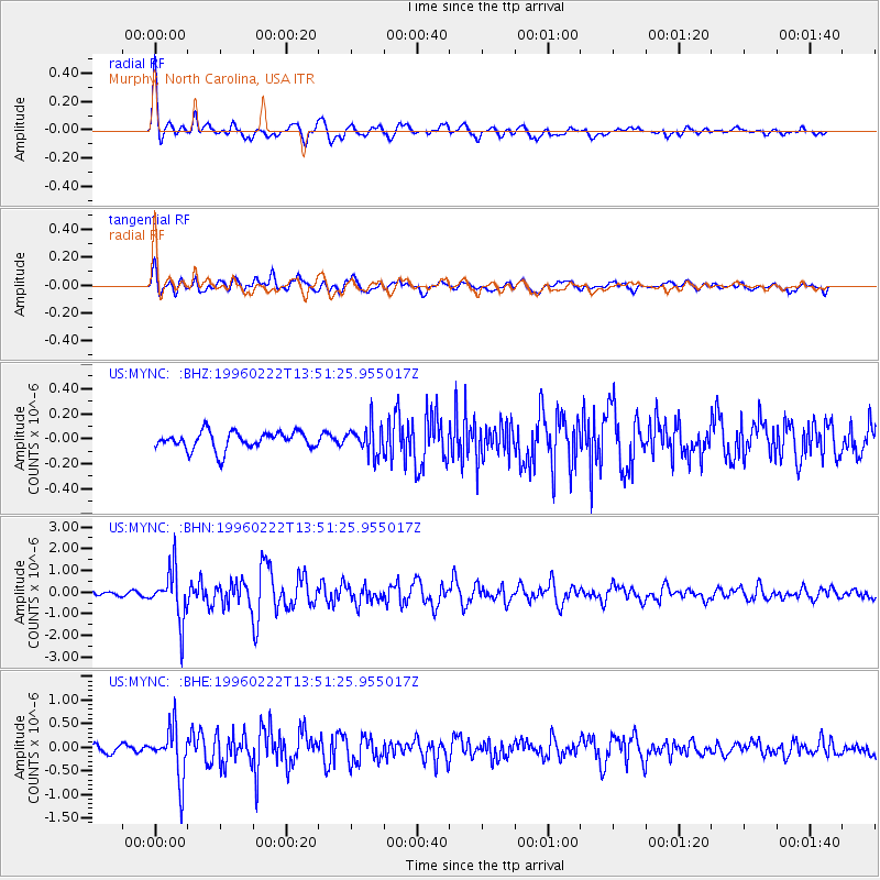
MYNC Murphy, North Carolina, USA - Earthquake Result Viewer
*The percent match for this event was below the threshold and hence no stack was calculated.
| Earthquake location: |
Near Coast Of Central Chile |
| Earthquake latitude/longitude: |
-33.7/-71.7 |
| Earthquake time(UTC): |
1996/02/22 (053) 13:40:53 GMT |
| Earthquake Depth: |
44 km |
| Earthquake Magnitude: |
5.9 MB, 5.5 MS, 6.0 UNKNOWN, 5.9 MW |
| Earthquake Catalog/Contributor: |
WHDF/NEIC |
|
| Network: |
US United States National Seismic Network |
| Station: |
MYNC Murphy, North Carolina, USA |
| Lat/Lon: |
35.07 N/84.13 W |
| Elevation: |
550 m |
|
| Distance: |
69.4 deg |
| Az: |
349.135 deg |
| Baz: |
168.954 deg |
| Ray Param: |
$rayparam |
*The percent match for this event was below the threshold and hence was not used in the summary stack. |
|
| Radial Match: |
79.964836 % |
| Radial Bump: |
400 |
| Transverse Match: |
73.672455 % |
| Transverse Bump: |
400 |
| SOD ConfigId: |
4480 |
| Insert Time: |
2010-03-05 06:39:21.328 +0000 |
| GWidth: |
2.5 |
| Max Bumps: |
400 |
| Tol: |
0.001 |
|
Signal To Noise
| Channel | StoN | STA | LTA |
| US:MYNC: :BHN:19960222T13:51:25.955017Z | 11.195627 | 1.1588648E-6 | 1.0351049E-7 |
| US:MYNC: :BHE:19960222T13:51:25.955017Z | 4.497337 | 5.415027E-7 | 1.2040518E-7 |
| US:MYNC: :BHZ:19960222T13:51:25.955017Z | 1.6704262 | 1.1834532E-7 | 7.084738E-8 |
| Arrivals |
| Ps | |
| PpPs | |
| PsPs/PpSs | |


