You are here: Home > Network List > US - United States National Seismic Network Stations List
> Station MYNC Murphy, North Carolina, USA > Earthquake Result Viewer
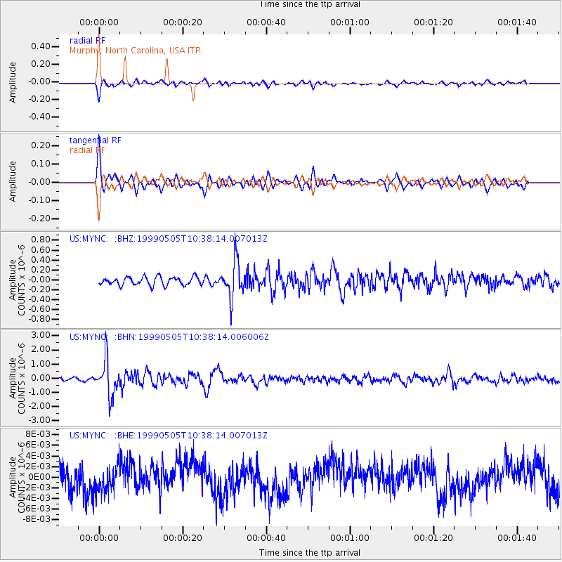
MYNC Murphy, North Carolina, USA - Earthquake Result Viewer
*The percent match for this event was below the threshold and hence no stack was calculated.
| Earthquake location: |
Kenai Peninsula, Alaska |
| Earthquake latitude/longitude: |
59.3/-151.5 |
| Earthquake time(UTC): |
1999/05/05 (125) 10:30:03 GMT |
| Earthquake Depth: |
71 km |
| Earthquake Magnitude: |
5.4 MB, 5.8 MW, 5.8 MW |
| Earthquake Catalog/Contributor: |
WHDF/NEIC |
|
| Network: |
US United States National Seismic Network |
| Station: |
MYNC Murphy, North Carolina, USA |
| Lat/Lon: |
35.07 N/84.13 W |
| Elevation: |
550 m |
|
| Distance: |
49.2 deg |
| Az: |
88.26 deg |
| Baz: |
321.287 deg |
| Ray Param: |
$rayparam |
*The percent match for this event was below the threshold and hence was not used in the summary stack. |
|
| Radial Match: |
77.61994 % |
| Radial Bump: |
392 |
| Transverse Match: |
77.73573 % |
| Transverse Bump: |
384 |
| SOD ConfigId: |
4480 |
| Insert Time: |
2010-03-05 06:39:26.551 +0000 |
| GWidth: |
2.5 |
| Max Bumps: |
400 |
| Tol: |
0.001 |
|
Signal To Noise
| Channel | StoN | STA | LTA |
| US:MYNC: :BHN:19990505T10:38:14.006006Z | 10.494933 | 1.2949769E-6 | 1.2339068E-7 |
| US:MYNC: :BHE:19990505T10:38:14.007013Z | 1.1814212 | 2.5614864E-9 | 2.16814E-9 |
| US:MYNC: :BHZ:19990505T10:38:14.007013Z | 4.566665 | 3.764319E-7 | 8.2430375E-8 |
| Arrivals |
| Ps | |
| PpPs | |
| PsPs/PpSs | |


