You are here: Home > Network List > TA - USArray Transportable Network (new EarthScope stations) Stations List
> Station D25K Kavik River, AK, USA > Earthquake Result Viewer
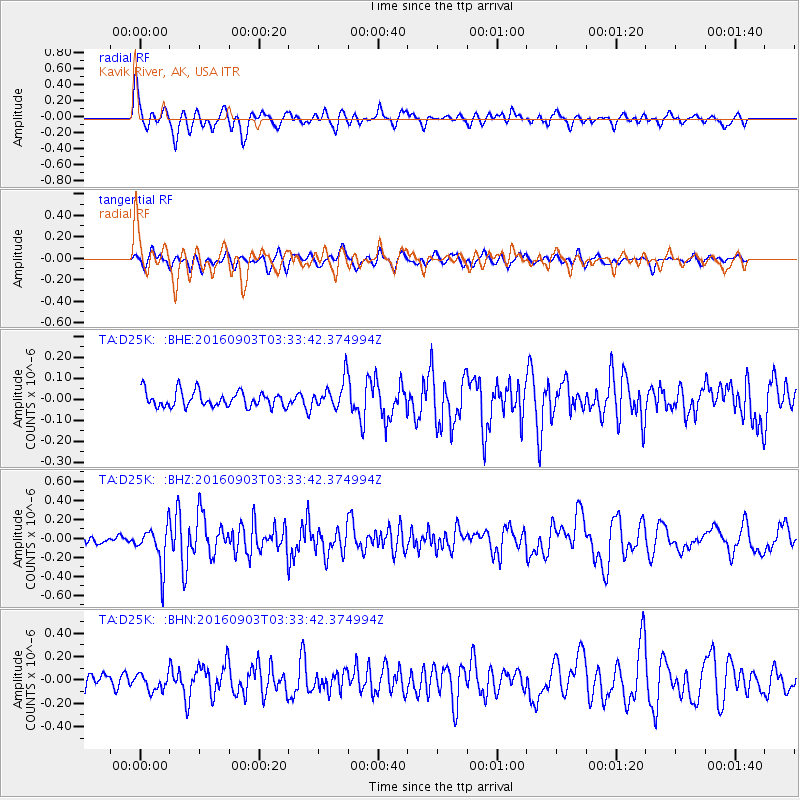
D25K Kavik River, AK, USA - Earthquake Result Viewer
*The percent match for this event was below the threshold and hence no stack was calculated.
| Earthquake location: |
Off Coast Of Northern California |
| Earthquake latitude/longitude: |
40.4/-125.7 |
| Earthquake time(UTC): |
2016/09/03 (247) 03:27:55 GMT |
| Earthquake Depth: |
2.2 km |
| Earthquake Magnitude: |
5.6 MW, 5.6 MW, 5.7 MI, 5.7 MWP |
| Earthquake Catalog/Contributor: |
NEIC PDE/NEIC COMCAT |
|
| Network: |
TA USArray Transportable Network (new EarthScope stations) |
| Station: |
D25K Kavik River, AK, USA |
| Lat/Lon: |
69.32 N/146.38 W |
| Elevation: |
770 m |
|
| Distance: |
31.0 deg |
| Az: |
345.864 deg |
| Baz: |
148.338 deg |
| Ray Param: |
$rayparam |
*The percent match for this event was below the threshold and hence was not used in the summary stack. |
|
| Radial Match: |
71.53978 % |
| Radial Bump: |
400 |
| Transverse Match: |
49.33063 % |
| Transverse Bump: |
400 |
| SOD ConfigId: |
11737051 |
| Insert Time: |
2019-04-25 10:42:10.210 +0000 |
| GWidth: |
2.5 |
| Max Bumps: |
400 |
| Tol: |
0.001 |
|
Signal To Noise
| Channel | StoN | STA | LTA |
| TA:D25K: :BHZ:20160903T03:33:42.374994Z | 3.9561188 | 2.1288743E-7 | 5.3812194E-8 |
| TA:D25K: :BHN:20160903T03:33:42.374994Z | 0.99565375 | 7.2539514E-8 | 7.285616E-8 |
| TA:D25K: :BHE:20160903T03:33:42.374994Z | 2.2436454 | 7.6639395E-8 | 3.4158425E-8 |
| Arrivals |
| Ps | |
| PpPs | |
| PsPs/PpSs | |


