AAM Ann Arbor, Michigan, USA - Earthquake Result Viewer
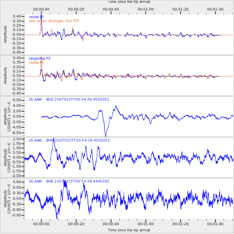
Earthquake location: Near West Coast Of Honshu, Japan
Earthquake latitude/longitude: 37.3/136.6
Earthquake time(UTC): 2007/03/25 (084) 00:41:57 GMT
Earthquake Depth: 8.0 km
Earthquake Magnitude: 6.1 MB, 6.8 MS, 6.7 MW, 6.6 MW
Earthquake Catalog/Contributor: WHDF/NEIC
Network: US United States National Seismic Network
Station: AAM Ann Arbor, Michigan, USA
Lat/Lon: 42.30 N/83.66 W
Elevation: 172 m
Distance: 92.7 deg
Az: 28.672 deg
Baz: 328.97 deg
Ray Param: 0.041415762
Estimated Moho Depth: 24.25 km
Estimated Crust Vp/Vs: 1.60
Assumed Crust Vp: 6.483 km/s
Estimated Crust Vs: 4.045 km/s
Estimated Crust Poisson's Ratio: 0.18
Radial Match: 90.92038 %
Radial Bump: 400
Transverse Match: 86.30765 %
Transverse Bump: 400
SOD ConfigId: 2564
Insert Time: 2010-03-05 06:40:23.137 +0000
GWidth: 2.5
Max Bumps: 400
Tol: 0.001

Signal To Noise

ChannelStoNSTALTA
US:AAM: :BHN:20070325T00:54:38.450005Z3.71591286.1875653E-71.6651535E-7
US:AAM: :BHE:20070325T00:54:38.449028Z1.81911482.9928714E-71.645235E-7
US:AAM: :BHZ:20070325T00:54:38.450005Z5.0302551.4452061E-62.8730275E-7
Arrivals
Ps2.3 SECOND
PpPs9.5 SECOND
PsPs/PpSs12 SECOND