AAM Ann Arbor, Michigan, USA - Earthquake Result Viewer
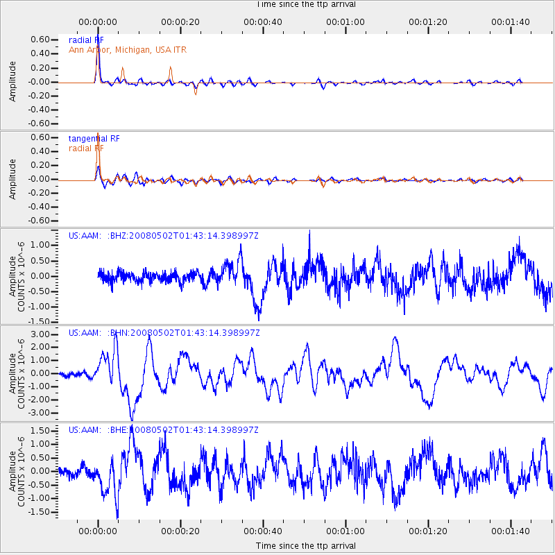
Earthquake location: Andreanof Islands, Aleutian Is.
Earthquake latitude/longitude: 51.9/-177.5
Earthquake time(UTC): 2008/05/02 (123) 01:33:37 GMT
Earthquake Depth: 14 km
Earthquake Magnitude: 6.3 MB, 6.8 MS, 6.6 MW, 6.6 MW
Earthquake Catalog/Contributor: WHDF/NEIC
Network: US United States National Seismic Network
Station: AAM Ann Arbor, Michigan, USA
Lat/Lon: 42.30 N/83.66 W
Elevation: 172 m
Distance: 60.3 deg
Az: 58.414 deg
Baz: 314.599 deg
Ray Param: 0.06159488
Estimated Moho Depth: 38.5 km
Estimated Crust Vp/Vs: 2.05
Assumed Crust Vp: 6.483 km/s
Estimated Crust Vs: 3.162 km/s
Estimated Crust Poisson's Ratio: 0.34
Radial Match: 94.245804 %
Radial Bump: 345
Transverse Match: 84.94312 %
Transverse Bump: 400
SOD ConfigId: 2504
Insert Time: 2010-03-05 06:40:28.731 +0000
GWidth: 2.5
Max Bumps: 400
Tol: 0.001

Signal To Noise

ChannelStoNSTALTA
US:AAM: :BHN:20080502T01:43:14.398997Z12.5405261.4599216E-61.1641629E-7
US:AAM: :BHE:20080502T01:43:14.398997Z4.8187896.8219407E-71.4156961E-7
US:AAM: :BHZ:20080502T01:43:14.398997Z2.86797744.156474E-71.4492701E-7
Arrivals
Ps6.5 SECOND
PpPs17 SECOND
PsPs/PpSs24 SECOND