You are here: Home > Network List > TA - USArray Transportable Network (new EarthScope stations) Stations List
> Station M31M Drury Creek, Yukon, CA > Earthquake Result Viewer
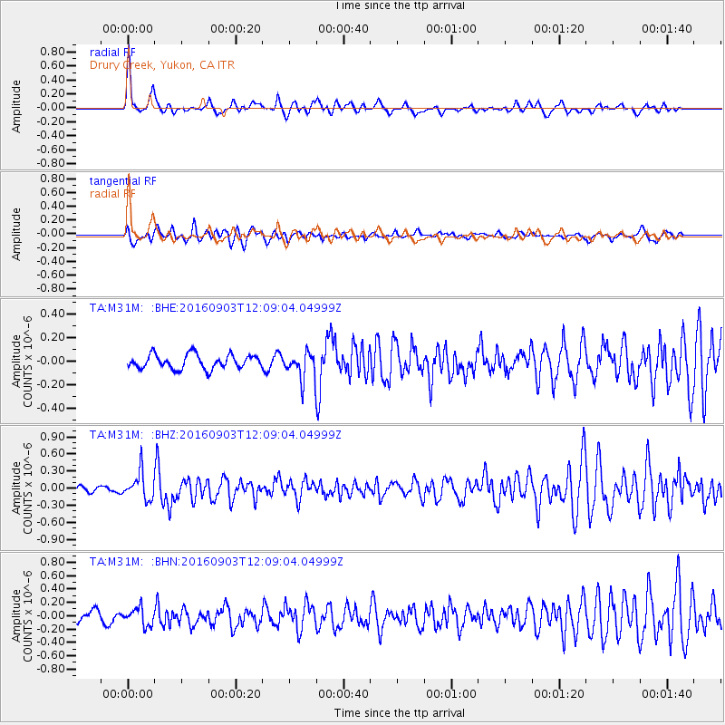
M31M Drury Creek, Yukon, CA - Earthquake Result Viewer
*The percent match for this event was below the threshold and hence no stack was calculated.
| Earthquake location: |
Oklahoma |
| Earthquake latitude/longitude: |
36.4/-96.9 |
| Earthquake time(UTC): |
2016/09/03 (247) 12:02:44 GMT |
| Earthquake Depth: |
5.4 km |
| Earthquake Magnitude: |
5.8 MWW, 5.6 MWB, 5.7 MWR, 5.8 MWC |
| Earthquake Catalog/Contributor: |
NEIC PDE/NEIC COMCAT |
|
| Network: |
TA USArray Transportable Network (new EarthScope stations) |
| Station: |
M31M Drury Creek, Yukon, CA |
| Lat/Lon: |
62.20 N/134.39 W |
| Elevation: |
639 m |
|
| Distance: |
34.7 deg |
| Az: |
329.924 deg |
| Baz: |
120.445 deg |
| Ray Param: |
$rayparam |
*The percent match for this event was below the threshold and hence was not used in the summary stack. |
|
| Radial Match: |
77.24044 % |
| Radial Bump: |
358 |
| Transverse Match: |
70.96738 % |
| Transverse Bump: |
400 |
| SOD ConfigId: |
11737051 |
| Insert Time: |
2019-04-25 10:47:58.197 +0000 |
| GWidth: |
2.5 |
| Max Bumps: |
400 |
| Tol: |
0.001 |
|
Signal To Noise
| Channel | StoN | STA | LTA |
| TA:M31M: :BHZ:20160903T12:09:04.04999Z | 4.690737 | 2.4099032E-7 | 5.1375796E-8 |
| TA:M31M: :BHN:20160903T12:09:04.04999Z | 1.6637957 | 1.326877E-7 | 7.9749995E-8 |
| TA:M31M: :BHE:20160903T12:09:04.04999Z | 1.8237607 | 1.084597E-7 | 5.947036E-8 |
| Arrivals |
| Ps | |
| PpPs | |
| PsPs/PpSs | |


