AAM Ann Arbor, Michigan, USA - Earthquake Result Viewer
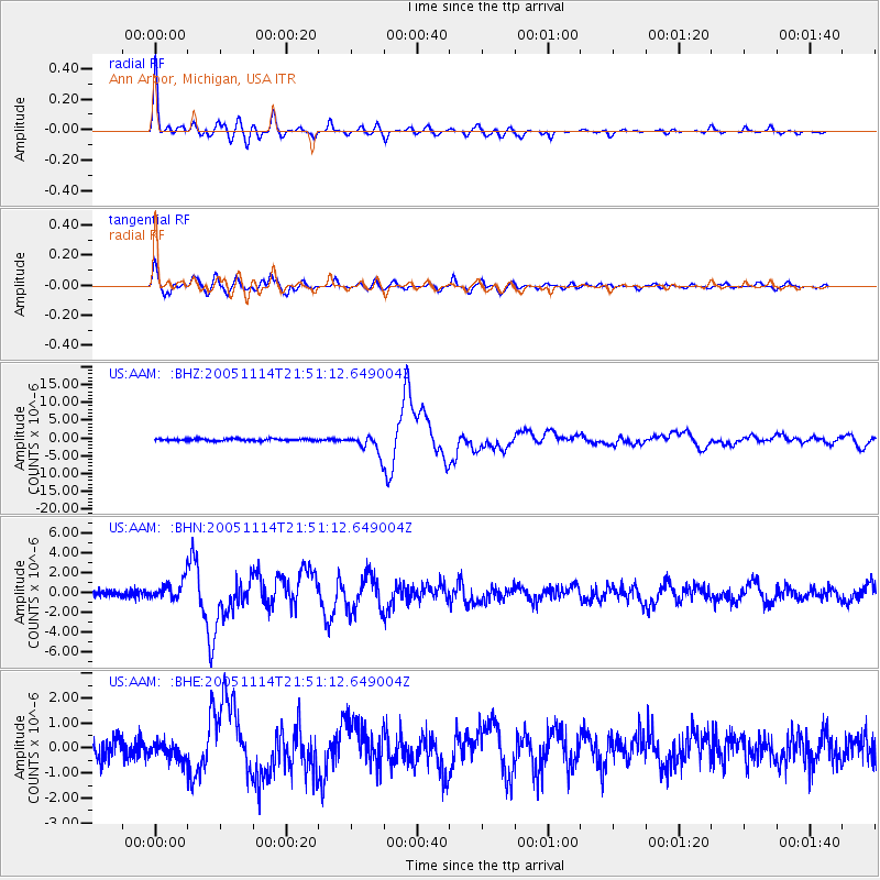
Earthquake location: Off East Coast Of Honshu, Japan
Earthquake latitude/longitude: 38.1/144.9
Earthquake time(UTC): 2005/11/14 (318) 21:38:51 GMT
Earthquake Depth: 11 km
Earthquake Magnitude: 6.7 MB, 6.8 MS, 7.0 MW, 6.9 MW
Earthquake Catalog/Contributor: WHDF/NEIC
Network: US United States National Seismic Network
Station: AAM Ann Arbor, Michigan, USA
Lat/Lon: 42.30 N/83.66 W
Elevation: 172 m
Distance: 88.6 deg
Az: 33.796 deg
Baz: 323.737 deg
Ray Param: 0.042476445
Estimated Moho Depth: 41.0 km
Estimated Crust Vp/Vs: 1.95
Assumed Crust Vp: 6.483 km/s
Estimated Crust Vs: 3.329 km/s
Estimated Crust Poisson's Ratio: 0.32
Radial Match: 97.34257 %
Radial Bump: 387
Transverse Match: 91.9287 %
Transverse Bump: 400
SOD ConfigId: 2448
Insert Time: 2010-03-05 06:40:49.508 +0000
GWidth: 2.5
Max Bumps: 400
Tol: 0.001

Signal To Noise

ChannelStoNSTALTA
US:AAM: :BHN:20051114T21:51:12.649004Z2.55510289.635341E-73.771019E-7
US:AAM: :BHE:20051114T21:51:12.649004Z0.976334453.4615772E-73.545483E-7
US:AAM: :BHZ:20051114T21:51:12.649004Z10.2194042.7257727E-62.667252E-7
Arrivals
Ps6.1 SECOND
PpPs18 SECOND
PsPs/PpSs24 SECOND