You are here: Home > Network List > US - United States National Seismic Network Stations List
> Station AMTX Amarillo, Texas, USA > Earthquake Result Viewer
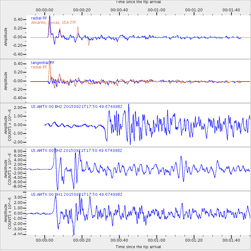
AMTX Amarillo, Texas, USA - Earthquake Result Viewer
*The percent match for this event was below the threshold and hence no stack was calculated.
| Earthquake location: |
Near Coast Of Central Chile |
| Earthquake latitude/longitude: |
-31.7/-71.6 |
| Earthquake time(UTC): |
2015/09/21 (264) 17:39:58 GMT |
| Earthquake Depth: |
25 km |
| Earthquake Magnitude: |
6.5 MB, 6.5 MI, 6.6 MWW |
| Earthquake Catalog/Contributor: |
NEIC PDE/NEIC COMCAT |
|
| Network: |
US United States National Seismic Network |
| Station: |
AMTX Amarillo, Texas, USA |
| Lat/Lon: |
34.53 N/101.41 W |
| Elevation: |
1010 m |
|
| Distance: |
71.6 deg |
| Az: |
334.407 deg |
| Baz: |
153.526 deg |
| Ray Param: |
$rayparam |
*The percent match for this event was below the threshold and hence was not used in the summary stack. |
|
| Radial Match: |
93.29484 % |
| Radial Bump: |
400 |
| Transverse Match: |
82.46177 % |
| Transverse Bump: |
400 |
| SOD ConfigId: |
1156111 |
| Insert Time: |
2015-10-05 18:00:28.307 +0000 |
| GWidth: |
2.5 |
| Max Bumps: |
400 |
| Tol: |
0.001 |
|
Signal To Noise
| Channel | StoN | STA | LTA |
| US:AMTX:00:BHZ:20150921T17:50:49.674998Z | 5.2904987 | 8.3945065E-7 | 1.5867136E-7 |
| US:AMTX:00:BH1:20150921T17:50:49.674998Z | 1.4071108 | 1.8480506E-7 | 1.3133653E-7 |
| US:AMTX:00:BH2:20150921T17:50:49.674998Z | 1.6124712 | 2.1681541E-7 | 1.3446157E-7 |
| Arrivals |
| Ps | |
| PpPs | |
| PsPs/PpSs | |


