You are here: Home > Network List > TA - USArray Transportable Network (new EarthScope stations) Stations List
> Station D23K Nanushuk River, AK USA > Earthquake Result Viewer
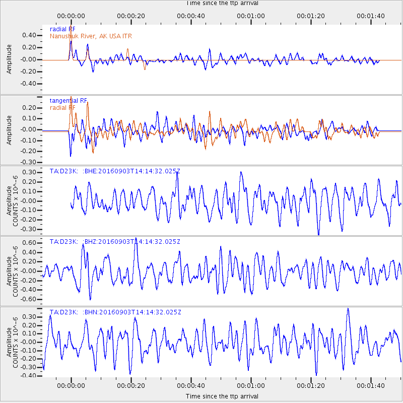
D23K Nanushuk River, AK USA - Earthquake Result Viewer
*The percent match for this event was below the threshold and hence no stack was calculated.
| Earthquake location: |
Mariana Islands Region |
| Earthquake latitude/longitude: |
20.3/147.4 |
| Earthquake time(UTC): |
2016/09/03 (247) 14:04:47 GMT |
| Earthquake Depth: |
10 km |
| Earthquake Magnitude: |
5.5 MB |
| Earthquake Catalog/Contributor: |
NEIC PDE/NEIC COMCAT |
|
| Network: |
TA USArray Transportable Network (new EarthScope stations) |
| Station: |
D23K Nanushuk River, AK USA |
| Lat/Lon: |
68.97 N/150.68 W |
| Elevation: |
406 m |
|
| Distance: |
61.3 deg |
| Az: |
21.303 deg |
| Baz: |
250.851 deg |
| Ray Param: |
$rayparam |
*The percent match for this event was below the threshold and hence was not used in the summary stack. |
|
| Radial Match: |
67.36391 % |
| Radial Bump: |
400 |
| Transverse Match: |
55.359463 % |
| Transverse Bump: |
400 |
| SOD ConfigId: |
11737051 |
| Insert Time: |
2019-04-25 10:53:45.934 +0000 |
| GWidth: |
2.5 |
| Max Bumps: |
400 |
| Tol: |
0.001 |
|
Signal To Noise
| Channel | StoN | STA | LTA |
| TA:D23K: :BHZ:20160903T14:14:32.025Z | 2.6078827 | 2.9204614E-7 | 1.1198592E-7 |
| TA:D23K: :BHN:20160903T14:14:32.025Z | 0.8538173 | 1.0403895E-7 | 1.2185154E-7 |
| TA:D23K: :BHE:20160903T14:14:32.025Z | 1.3515313 | 1.1348877E-7 | 8.397051E-8 |
| Arrivals |
| Ps | |
| PpPs | |
| PsPs/PpSs | |


