You are here: Home > Network List > AV - Alaska Volcano Observatory Stations List
> Station MAPS Pakushin Southeast, Makushin Volcano, Alaska > Earthquake Result Viewer
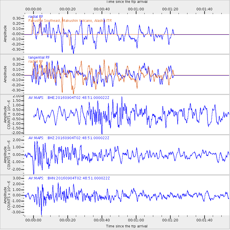
MAPS Pakushin Southeast, Makushin Volcano, Alaska - Earthquake Result Viewer
*The percent match for this event was below the threshold and hence no stack was calculated.
| Earthquake location: |
Mindanao, Philippines |
| Earthquake latitude/longitude: |
8.4/125.9 |
| Earthquake time(UTC): |
2016/09/04 (248) 02:38:12 GMT |
| Earthquake Depth: |
12 km |
| Earthquake Magnitude: |
5.9 MWP |
| Earthquake Catalog/Contributor: |
NEIC PDE/NEIC COMCAT |
|
| Network: |
AV Alaska Volcano Observatory |
| Station: |
MAPS Pakushin Southeast, Makushin Volcano, Alaska |
| Lat/Lon: |
53.81 N/166.94 W |
| Elevation: |
333 m |
|
| Distance: |
69.8 deg |
| Az: |
35.602 deg |
| Baz: |
256.225 deg |
| Ray Param: |
$rayparam |
*The percent match for this event was below the threshold and hence was not used in the summary stack. |
|
| Radial Match: |
58.33304 % |
| Radial Bump: |
400 |
| Transverse Match: |
60.266018 % |
| Transverse Bump: |
400 |
| SOD ConfigId: |
11737051 |
| Insert Time: |
2019-04-25 10:58:12.812 +0000 |
| GWidth: |
2.5 |
| Max Bumps: |
400 |
| Tol: |
0.001 |
|
Signal To Noise
| Channel | StoN | STA | LTA |
| AV:MAPS: :BHZ:20160904T02:48:51.000022Z | 3.8258119 | 1.1689766E-6 | 3.0554995E-7 |
| AV:MAPS: :BHN:20160904T02:48:51.000022Z | 3.2984462 | 1.1085467E-6 | 3.3608148E-7 |
| AV:MAPS: :BHE:20160904T02:48:51.000022Z | 1.4003989 | 6.2079766E-7 | 4.4330062E-7 |
| Arrivals |
| Ps | |
| PpPs | |
| PsPs/PpSs | |


