You are here: Home > Network List > TA - USArray Transportable Network (new EarthScope stations) Stations List
> Station M31M Drury Creek, Yukon, CA > Earthquake Result Viewer
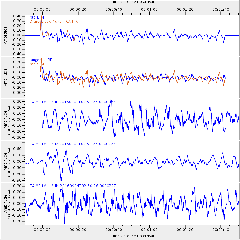
M31M Drury Creek, Yukon, CA - Earthquake Result Viewer
*The percent match for this event was below the threshold and hence no stack was calculated.
| Earthquake location: |
Mindanao, Philippines |
| Earthquake latitude/longitude: |
8.4/125.9 |
| Earthquake time(UTC): |
2016/09/04 (248) 02:38:12 GMT |
| Earthquake Depth: |
12 km |
| Earthquake Magnitude: |
5.9 MWP |
| Earthquake Catalog/Contributor: |
NEIC PDE/NEIC COMCAT |
|
| Network: |
TA USArray Transportable Network (new EarthScope stations) |
| Station: |
M31M Drury Creek, Yukon, CA |
| Lat/Lon: |
62.20 N/134.39 W |
| Elevation: |
639 m |
|
| Distance: |
87.1 deg |
| Az: |
27.56 deg |
| Baz: |
282.436 deg |
| Ray Param: |
$rayparam |
*The percent match for this event was below the threshold and hence was not used in the summary stack. |
|
| Radial Match: |
61.974606 % |
| Radial Bump: |
400 |
| Transverse Match: |
56.351414 % |
| Transverse Bump: |
400 |
| SOD ConfigId: |
11737051 |
| Insert Time: |
2019-04-25 11:01:34.171 +0000 |
| GWidth: |
2.5 |
| Max Bumps: |
400 |
| Tol: |
0.001 |
|
Signal To Noise
| Channel | StoN | STA | LTA |
| TA:M31M: :BHZ:20160904T02:50:26.000022Z | 2.6884062 | 2.9111294E-7 | 1.0828458E-7 |
| TA:M31M: :BHN:20160904T02:50:26.000022Z | 0.7872327 | 7.7310666E-8 | 9.820561E-8 |
| TA:M31M: :BHE:20160904T02:50:26.000022Z | 0.86730266 | 9.160655E-8 | 1.0562236E-7 |
| Arrivals |
| Ps | |
| PpPs | |
| PsPs/PpSs | |


