You are here: Home > Network List > TA - USArray Transportable Network (new EarthScope stations) Stations List
> Station R17K Ugashik Creek, AK, USA > Earthquake Result Viewer
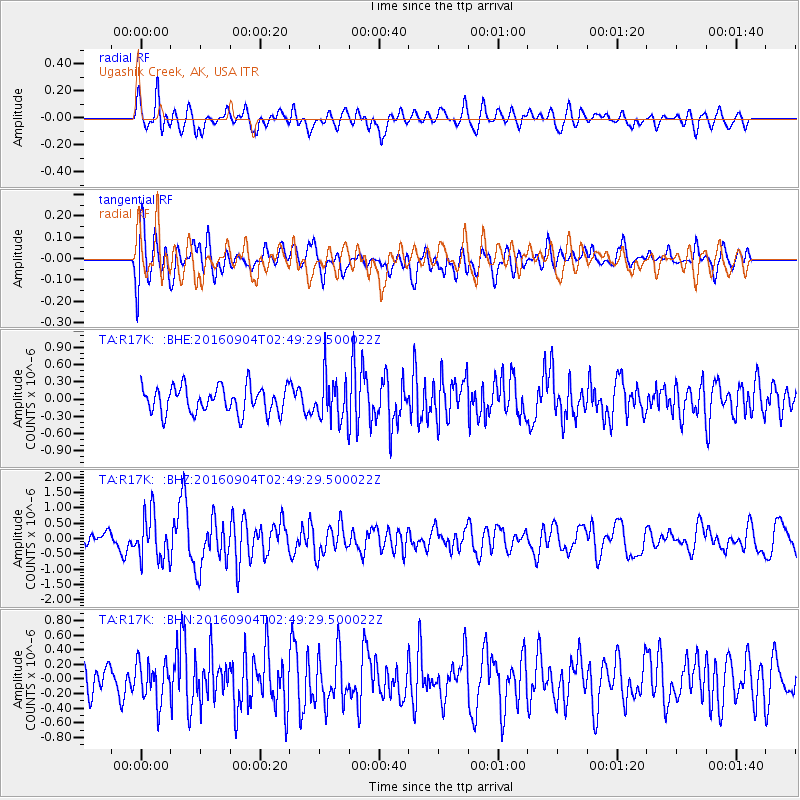
R17K Ugashik Creek, AK, USA - Earthquake Result Viewer
*The percent match for this event was below the threshold and hence no stack was calculated.
| Earthquake location: |
Mindanao, Philippines |
| Earthquake latitude/longitude: |
8.4/125.9 |
| Earthquake time(UTC): |
2016/09/04 (248) 02:38:12 GMT |
| Earthquake Depth: |
12 km |
| Earthquake Magnitude: |
5.9 MWP |
| Earthquake Catalog/Contributor: |
NEIC PDE/NEIC COMCAT |
|
| Network: |
TA USArray Transportable Network (new EarthScope stations) |
| Station: |
R17K Ugashik Creek, AK, USA |
| Lat/Lon: |
57.64 N/156.39 W |
| Elevation: |
273 m |
|
| Distance: |
76.4 deg |
| Az: |
32.729 deg |
| Baz: |
264.104 deg |
| Ray Param: |
$rayparam |
*The percent match for this event was below the threshold and hence was not used in the summary stack. |
|
| Radial Match: |
60.622265 % |
| Radial Bump: |
400 |
| Transverse Match: |
63.828854 % |
| Transverse Bump: |
400 |
| SOD ConfigId: |
11737051 |
| Insert Time: |
2019-04-25 11:01:57.333 +0000 |
| GWidth: |
2.5 |
| Max Bumps: |
400 |
| Tol: |
0.001 |
|
Signal To Noise
| Channel | StoN | STA | LTA |
| TA:R17K: :BHZ:20160904T02:49:29.500022Z | 2.7435622 | 7.428673E-7 | 2.7076743E-7 |
| TA:R17K: :BHN:20160904T02:49:29.500022Z | 1.2908924 | 2.706594E-7 | 2.0966844E-7 |
| TA:R17K: :BHE:20160904T02:49:29.500022Z | 1.8319503 | 4.1811933E-7 | 2.2823727E-7 |
| Arrivals |
| Ps | |
| PpPs | |
| PsPs/PpSs | |


