You are here: Home > Network List > CI - Caltech Regional Seismic Network Stations List
> Station MPM Manuel Prospect Mine, California, USA > Earthquake Result Viewer
MPM Manuel Prospect Mine, California, USA - Earthquake Result Viewer
*The percent match for this event was below the threshold and hence no stack was calculated.
| Earthquake location: |
Santa Cruz Islands |
| Earthquake latitude/longitude: |
-11.0/166.0 |
| Earthquake time(UTC): |
2016/09/06 (250) 04:13:35 GMT |
| Earthquake Depth: |
73 km |
| Earthquake Magnitude: |
5.8 MB |
| Earthquake Catalog/Contributor: |
NEIC PDE/NEIC ALERT |
|
| Network: |
CI Caltech Regional Seismic Network |
| Station: |
MPM Manuel Prospect Mine, California, USA |
| Lat/Lon: |
36.06 N/117.49 W |
| Elevation: |
185 m |
|
| Distance: |
85.7 deg |
| Az: |
52.203 deg |
| Baz: |
253.263 deg |
| Ray Param: |
$rayparam |
*The percent match for this event was below the threshold and hence was not used in the summary stack. |
|
| Radial Match: |
56.391487 % |
| Radial Bump: |
400 |
| Transverse Match: |
49.339893 % |
| Transverse Bump: |
400 |
| SOD ConfigId: |
11737051 |
| Insert Time: |
2019-04-25 11:20:43.605 +0000 |
| GWidth: |
2.5 |
| Max Bumps: |
400 |
| Tol: |
0.001 |
|
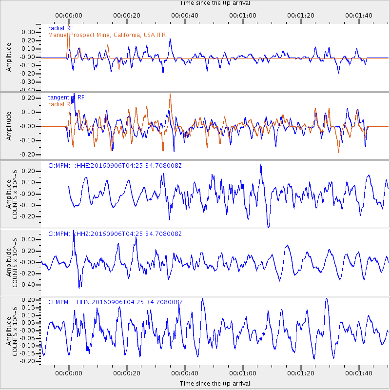
Signal To Noise
| Channel | StoN | STA | LTA |
| CI:MPM: :HHZ:20160906T04:25:34.708008Z | 4.0424914 | 2.3837265E-7 | 5.8966766E-8 |
| CI:MPM: :HHN:20160906T04:25:34.708008Z | 1.5281286 | 7.996769E-8 | 5.2330467E-8 |
| CI:MPM: :HHE:20160906T04:25:34.708008Z | 1.2721821 | 9.318185E-8 | 7.324569E-8 |
| Arrivals |
| Ps | |
| PpPs | |
| PsPs/PpSs | |


