You are here: Home > Network List > AZ - ANZA Regional Network Stations List
> Station SMER AZ.SMER > Earthquake Result Viewer
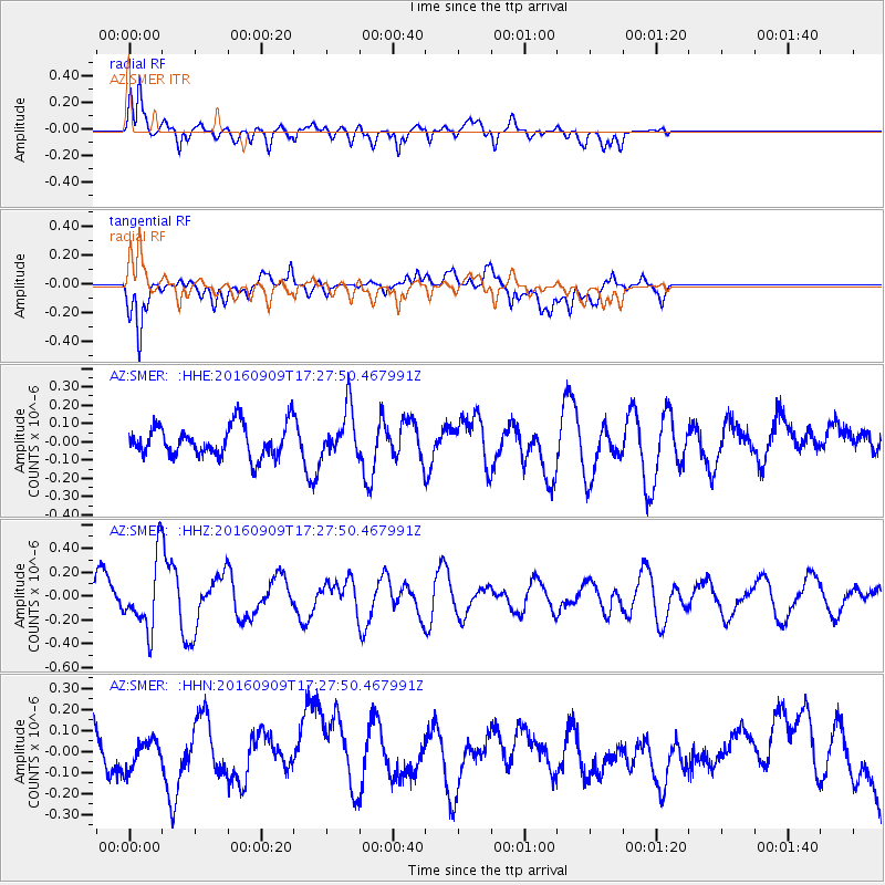
SMER AZ.SMER - Earthquake Result Viewer
*The percent match for this event was below the threshold and hence no stack was calculated.
| Earthquake location: |
Northern Mid-Atlantic Ridge |
| Earthquake latitude/longitude: |
22.1/-45.9 |
| Earthquake time(UTC): |
2016/09/09 (253) 17:17:54 GMT |
| Earthquake Depth: |
10 km |
| Earthquake Magnitude: |
5.5 MB |
| Earthquake Catalog/Contributor: |
NEIC PDE/NEIC COMCAT |
|
| Network: |
AZ ANZA Regional Network |
| Station: |
SMER AZ.SMER |
| Lat/Lon: |
33.46 N/117.17 W |
| Elevation: |
355 m |
|
| Distance: |
63.0 deg |
| Az: |
297.294 deg |
| Baz: |
80.322 deg |
| Ray Param: |
$rayparam |
*The percent match for this event was below the threshold and hence was not used in the summary stack. |
|
| Radial Match: |
70.818504 % |
| Radial Bump: |
400 |
| Transverse Match: |
45.959736 % |
| Transverse Bump: |
400 |
| SOD ConfigId: |
11737051 |
| Insert Time: |
2019-04-25 11:39:46.502 +0000 |
| GWidth: |
2.5 |
| Max Bumps: |
400 |
| Tol: |
0.001 |
|
Signal To Noise
| Channel | StoN | STA | LTA |
| AZ:SMER: :HHZ:20160909T17:27:50.467991Z | 2.450054 | 2.8482637E-7 | 1.16253105E-7 |
| AZ:SMER: :HHN:20160909T17:27:50.467991Z | 0.44230276 | 6.986191E-8 | 1.5795042E-7 |
| AZ:SMER: :HHE:20160909T17:27:50.467991Z | 1.5594211 | 1.3138694E-7 | 8.4253664E-8 |
| Arrivals |
| Ps | |
| PpPs | |
| PsPs/PpSs | |


