You are here: Home > Network List > CI - Caltech Regional Seismic Network Stations List
> Station MPM Manuel Prospect Mine, California, USA > Earthquake Result Viewer
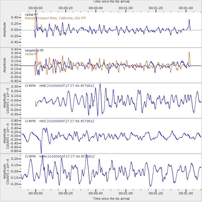
MPM Manuel Prospect Mine, California, USA - Earthquake Result Viewer
*The percent match for this event was below the threshold and hence no stack was calculated.
| Earthquake location: |
Northern Mid-Atlantic Ridge |
| Earthquake latitude/longitude: |
22.1/-45.9 |
| Earthquake time(UTC): |
2016/09/09 (253) 17:17:54 GMT |
| Earthquake Depth: |
10 km |
| Earthquake Magnitude: |
5.5 MB |
| Earthquake Catalog/Contributor: |
NEIC PDE/NEIC COMCAT |
|
| Network: |
CI Caltech Regional Seismic Network |
| Station: |
MPM Manuel Prospect Mine, California, USA |
| Lat/Lon: |
36.06 N/117.49 W |
| Elevation: |
185 m |
|
| Distance: |
62.9 deg |
| Az: |
300.217 deg |
| Baz: |
81.471 deg |
| Ray Param: |
$rayparam |
*The percent match for this event was below the threshold and hence was not used in the summary stack. |
|
| Radial Match: |
62.161884 % |
| Radial Bump: |
400 |
| Transverse Match: |
77.384834 % |
| Transverse Bump: |
400 |
| SOD ConfigId: |
11737051 |
| Insert Time: |
2019-04-25 11:40:47.879 +0000 |
| GWidth: |
2.5 |
| Max Bumps: |
400 |
| Tol: |
0.001 |
|
Signal To Noise
| Channel | StoN | STA | LTA |
| CI:MPM: :HHZ:20160909T17:27:49.457981Z | 1.8196582 | 2.942885E-7 | 1.6172734E-7 |
| CI:MPM: :HHN:20160909T17:27:49.457981Z | 1.3150489 | 1.1592756E-7 | 8.815456E-8 |
| CI:MPM: :HHE:20160909T17:27:49.457981Z | 1.2311546 | 1.0132784E-7 | 8.23031E-8 |
| Arrivals |
| Ps | |
| PpPs | |
| PsPs/PpSs | |


