You are here: Home > Network List > II - Global Seismograph Network (GSN - IRIS/IDA) Stations List
> Station SUR Sutherland, South Africa > Earthquake Result Viewer
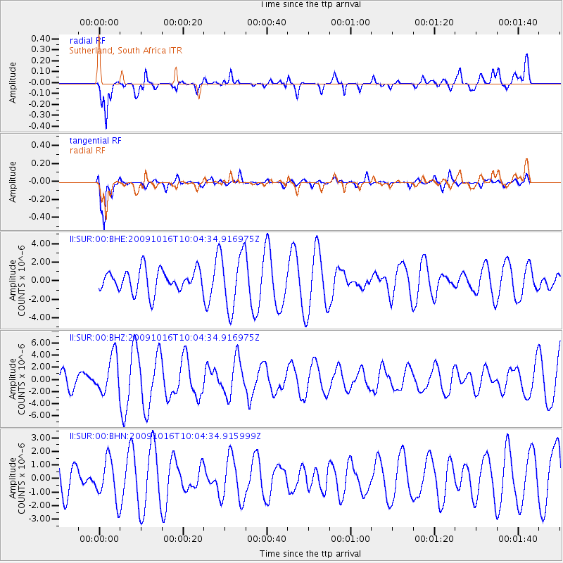
SUR Sutherland, South Africa - Earthquake Result Viewer
*The percent match for this event was below the threshold and hence no stack was calculated.
| Earthquake location: |
Sunda Strait, Indonesia |
| Earthquake latitude/longitude: |
-6.5/105.2 |
| Earthquake time(UTC): |
2009/10/16 (289) 09:52:50 GMT |
| Earthquake Depth: |
38 km |
| Earthquake Magnitude: |
5.9 MB, 5.8 MS, 6.1 MW, 6.1 MW |
| Earthquake Catalog/Contributor: |
WHDF/NEIC |
|
| Network: |
II Global Seismograph Network (GSN - IRIS/IDA) |
| Station: |
SUR Sutherland, South Africa |
| Lat/Lon: |
32.38 S/20.81 E |
| Elevation: |
1770 m |
|
| Distance: |
81.8 deg |
| Az: |
238.294 deg |
| Baz: |
92.552 deg |
| Ray Param: |
$rayparam |
*The percent match for this event was below the threshold and hence was not used in the summary stack. |
|
| Radial Match: |
65.16054 % |
| Radial Bump: |
400 |
| Transverse Match: |
84.373825 % |
| Transverse Bump: |
400 |
| SOD ConfigId: |
1 |
| Insert Time: |
2010-02-19 00:49:34.719 +0000 |
| GWidth: |
2.5 |
| Max Bumps: |
400 |
| Tol: |
0.001 |
|
Signal To Noise
| Channel | StoN | STA | LTA |
| II:SUR:00:BHZ:20091016T10:04:34.916975Z | 1.8715094 | 3.186819E-6 | 1.7028068E-6 |
| II:SUR:00:BHN:20091016T10:04:34.915999Z | 1.6149436 | 1.5549548E-6 | 9.62854E-7 |
| II:SUR:00:BHE:20091016T10:04:34.916975Z | 2.5475361 | 3.0127248E-6 | 1.1826033E-6 |
| Arrivals |
| Ps | |
| PpPs | |
| PsPs/PpSs | |


