You are here: Home > Network List > TA - USArray Transportable Network (new EarthScope stations) Stations List
> Station BGNE Belgrade, NE, USA > Earthquake Result Viewer
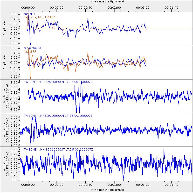
BGNE Belgrade, NE, USA - Earthquake Result Viewer
*The percent match for this event was below the threshold and hence no stack was calculated.
| Earthquake location: |
Northern Mid-Atlantic Ridge |
| Earthquake latitude/longitude: |
22.1/-45.9 |
| Earthquake time(UTC): |
2016/09/09 (253) 17:17:54 GMT |
| Earthquake Depth: |
10 km |
| Earthquake Magnitude: |
5.5 MB |
| Earthquake Catalog/Contributor: |
NEIC PDE/NEIC COMCAT |
|
| Network: |
TA USArray Transportable Network (new EarthScope stations) |
| Station: |
BGNE Belgrade, NE, USA |
| Lat/Lon: |
41.41 N/98.15 W |
| Elevation: |
573 m |
|
| Distance: |
47.7 deg |
| Az: |
306.407 deg |
| Baz: |
97.165 deg |
| Ray Param: |
$rayparam |
*The percent match for this event was below the threshold and hence was not used in the summary stack. |
|
| Radial Match: |
67.1109 % |
| Radial Bump: |
400 |
| Transverse Match: |
50.97107 % |
| Transverse Bump: |
400 |
| SOD ConfigId: |
11737051 |
| Insert Time: |
2019-04-25 11:47:20.126 +0000 |
| GWidth: |
2.5 |
| Max Bumps: |
400 |
| Tol: |
0.001 |
|
Signal To Noise
| Channel | StoN | STA | LTA |
| TA:BGNE: :HHZ:20160909T17:26:00.160007Z | 4.0963373 | 5.700832E-7 | 1.3916902E-7 |
| TA:BGNE: :HHN:20160909T17:26:00.160007Z | 1.1248659 | 2.3409865E-7 | 2.081125E-7 |
| TA:BGNE: :HHE:20160909T17:26:00.160007Z | 2.2250211 | 5.186664E-7 | 2.3310628E-7 |
| Arrivals |
| Ps | |
| PpPs | |
| PsPs/PpSs | |


