You are here: Home > Network List > TA - USArray Transportable Network (new EarthScope stations) Stations List
> Station G21K Allakaket, AK, USA > Earthquake Result Viewer
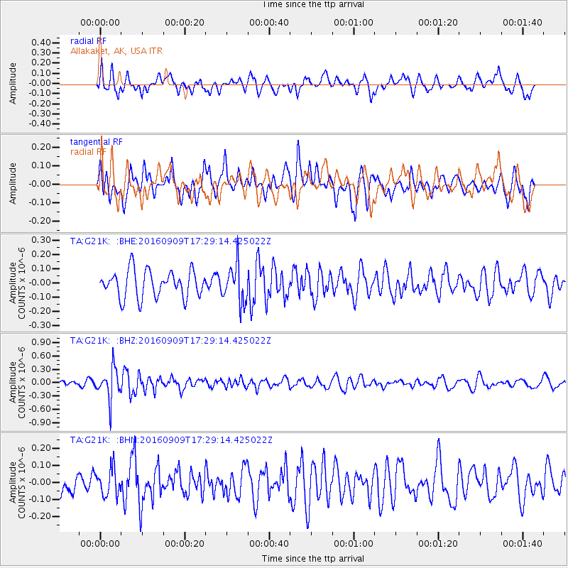
G21K Allakaket, AK, USA - Earthquake Result Viewer
*The percent match for this event was below the threshold and hence no stack was calculated.
| Earthquake location: |
Northern Mid-Atlantic Ridge |
| Earthquake latitude/longitude: |
22.1/-45.9 |
| Earthquake time(UTC): |
2016/09/09 (253) 17:17:54 GMT |
| Earthquake Depth: |
10 km |
| Earthquake Magnitude: |
5.5 MB |
| Earthquake Catalog/Contributor: |
NEIC PDE/NEIC COMCAT |
|
| Network: |
TA USArray Transportable Network (new EarthScope stations) |
| Station: |
G21K Allakaket, AK, USA |
| Lat/Lon: |
66.52 N/153.51 W |
| Elevation: |
446 m |
|
| Distance: |
76.7 deg |
| Az: |
336.894 deg |
| Baz: |
65.24 deg |
| Ray Param: |
$rayparam |
*The percent match for this event was below the threshold and hence was not used in the summary stack. |
|
| Radial Match: |
54.61084 % |
| Radial Bump: |
400 |
| Transverse Match: |
58.9952 % |
| Transverse Bump: |
400 |
| SOD ConfigId: |
11737051 |
| Insert Time: |
2019-04-25 11:47:36.130 +0000 |
| GWidth: |
2.5 |
| Max Bumps: |
400 |
| Tol: |
0.001 |
|
Signal To Noise
| Channel | StoN | STA | LTA |
| TA:G21K: :BHZ:20160909T17:29:14.425022Z | 7.18619 | 3.559693E-7 | 4.953519E-8 |
| TA:G21K: :BHN:20160909T17:29:14.425022Z | 1.4165729 | 7.772653E-8 | 5.4869417E-8 |
| TA:G21K: :BHE:20160909T17:29:14.425022Z | 1.4187219 | 1.3430254E-7 | 9.466446E-8 |
| Arrivals |
| Ps | |
| PpPs | |
| PsPs/PpSs | |


