You are here: Home > Network List > US - United States National Seismic Network Stations List
> Station MNV Mina, Nevada, USA > Earthquake Result Viewer
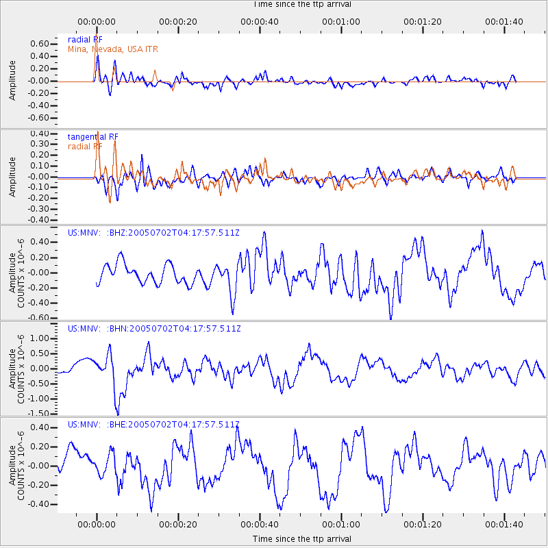
MNV Mina, Nevada, USA - Earthquake Result Viewer
*The percent match for this event was below the threshold and hence no stack was calculated.
| Earthquake location: |
Near Coast Of Nicaragua |
| Earthquake latitude/longitude: |
11.4/-86.3 |
| Earthquake time(UTC): |
2005/07/02 (183) 04:11:04 GMT |
| Earthquake Depth: |
40 km |
| Earthquake Magnitude: |
5.4 MB, 5.4 MS, 5.8 MW, 5.0 MD |
| Earthquake Catalog/Contributor: |
WHDF/NEIC |
|
| Network: |
US United States National Seismic Network |
| Station: |
MNV Mina, Nevada, USA |
| Lat/Lon: |
38.43 N/118.15 W |
| Elevation: |
1524 m |
|
| Distance: |
39.2 deg |
| Az: |
318.911 deg |
| Baz: |
124.862 deg |
| Ray Param: |
$rayparam |
*The percent match for this event was below the threshold and hence was not used in the summary stack. |
|
| Radial Match: |
71.08826 % |
| Radial Bump: |
400 |
| Transverse Match: |
72.30939 % |
| Transverse Bump: |
400 |
| SOD ConfigId: |
3128 |
| Insert Time: |
2010-03-05 06:50:27.571 +0000 |
| GWidth: |
2.5 |
| Max Bumps: |
400 |
| Tol: |
0.001 |
|
Signal To Noise
| Channel | StoN | STA | LTA |
| US:MNV: :BHN:20050702T04:17:57.511Z | 4.5271974 | 5.1149937E-7 | 1.1298367E-7 |
| US:MNV: :BHE:20050702T04:17:57.511Z | 1.131243 | 1.1379358E-7 | 1.0059164E-7 |
| US:MNV: :BHZ:20050702T04:17:57.511Z | 1.7214707 | 2.106885E-7 | 1.2238867E-7 |
| Arrivals |
| Ps | |
| PpPs | |
| PsPs/PpSs | |


