You are here: Home > Network List > US - United States National Seismic Network Stations List
> Station MNV Mina, Nevada, USA > Earthquake Result Viewer
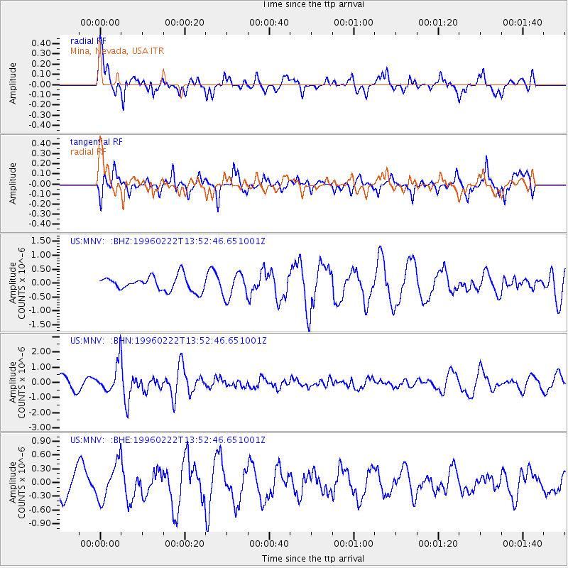
MNV Mina, Nevada, USA - Earthquake Result Viewer
*The percent match for this event was below the threshold and hence no stack was calculated.
| Earthquake location: |
Near Coast Of Central Chile |
| Earthquake latitude/longitude: |
-33.7/-71.7 |
| Earthquake time(UTC): |
1996/02/22 (053) 13:40:53 GMT |
| Earthquake Depth: |
44 km |
| Earthquake Magnitude: |
5.9 MB, 5.5 MS, 6.0 UNKNOWN, 5.9 MW |
| Earthquake Catalog/Contributor: |
WHDF/NEIC |
|
| Network: |
US United States National Seismic Network |
| Station: |
MNV Mina, Nevada, USA |
| Lat/Lon: |
38.43 N/118.15 W |
| Elevation: |
1524 m |
|
| Distance: |
83.7 deg |
| Az: |
325.067 deg |
| Baz: |
142.563 deg |
| Ray Param: |
$rayparam |
*The percent match for this event was below the threshold and hence was not used in the summary stack. |
|
| Radial Match: |
74.593315 % |
| Radial Bump: |
400 |
| Transverse Match: |
62.023834 % |
| Transverse Bump: |
332 |
| SOD ConfigId: |
4480 |
| Insert Time: |
2010-03-05 06:50:28.223 +0000 |
| GWidth: |
2.5 |
| Max Bumps: |
400 |
| Tol: |
0.001 |
|
Signal To Noise
| Channel | StoN | STA | LTA |
| US:MNV: :BHN:19960222T13:52:46.651001Z | 2.9415603 | 9.690527E-7 | 3.2943498E-7 |
| US:MNV: :BHE:19960222T13:52:46.651001Z | 1.3845232 | 4.126937E-7 | 2.9807643E-7 |
| US:MNV: :BHZ:19960222T13:52:46.651001Z | 1.746049 | 4.4717012E-7 | 2.56104E-7 |
| Arrivals |
| Ps | |
| PpPs | |
| PsPs/PpSs | |


