You are here: Home > Network List > US - United States National Seismic Network Stations List
> Station MNV Mina, Nevada, USA > Earthquake Result Viewer
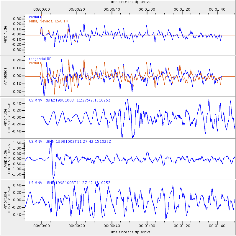
MNV Mina, Nevada, USA - Earthquake Result Viewer
*The percent match for this event was below the threshold and hence no stack was calculated.
| Earthquake location: |
Northwest Of Ryukyu Islands |
| Earthquake latitude/longitude: |
28.5/127.6 |
| Earthquake time(UTC): |
1998/10/03 (276) 11:15:42 GMT |
| Earthquake Depth: |
227 km |
| Earthquake Magnitude: |
5.6 MB, 6.1 UNKNOWN, 6.1 MW |
| Earthquake Catalog/Contributor: |
WHDF/NEIC |
|
| Network: |
US United States National Seismic Network |
| Station: |
MNV Mina, Nevada, USA |
| Lat/Lon: |
38.43 N/118.15 W |
| Elevation: |
1524 m |
|
| Distance: |
89.4 deg |
| Az: |
45.742 deg |
| Baz: |
306.62 deg |
| Ray Param: |
$rayparam |
*The percent match for this event was below the threshold and hence was not used in the summary stack. |
|
| Radial Match: |
61.124756 % |
| Radial Bump: |
400 |
| Transverse Match: |
63.746807 % |
| Transverse Bump: |
400 |
| SOD ConfigId: |
4480 |
| Insert Time: |
2010-03-05 06:50:31.399 +0000 |
| GWidth: |
2.5 |
| Max Bumps: |
400 |
| Tol: |
0.001 |
|
Signal To Noise
| Channel | StoN | STA | LTA |
| US:MNV: :BHN:19981003T11:27:42.151025Z | 2.148916 | 3.1009176E-7 | 1.4430147E-7 |
| US:MNV: :BHE:19981003T11:27:42.151025Z | 0.5357011 | 9.042231E-8 | 1.6879247E-7 |
| US:MNV: :BHZ:19981003T11:27:42.151025Z | 1.4782424 | 1.5895158E-7 | 1.0752741E-7 |
| Arrivals |
| Ps | |
| PpPs | |
| PsPs/PpSs | |


