You are here: Home > Network List > US - United States National Seismic Network Stations List
> Station MNV Mina, Nevada, USA > Earthquake Result Viewer
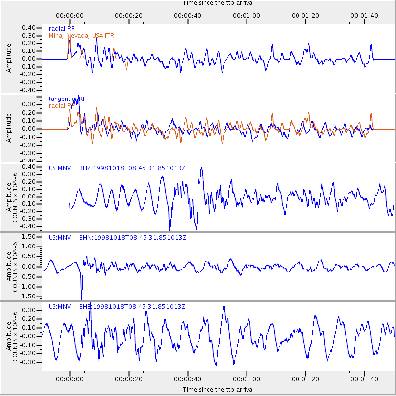
MNV Mina, Nevada, USA - Earthquake Result Viewer
*The percent match for this event was below the threshold and hence no stack was calculated.
| Earthquake location: |
Mariana Islands |
| Earthquake latitude/longitude: |
19.3/145.3 |
| Earthquake time(UTC): |
1998/10/18 (291) 08:33:54 GMT |
| Earthquake Depth: |
152 km |
| Earthquake Magnitude: |
5.5 UNKNOWN, 5.4 MB, 5.5 MW |
| Earthquake Catalog/Contributor: |
WHDF/NEIC |
|
| Network: |
US United States National Seismic Network |
| Station: |
MNV Mina, Nevada, USA |
| Lat/Lon: |
38.43 N/118.15 W |
| Elevation: |
1524 m |
|
| Distance: |
83.2 deg |
| Az: |
51.805 deg |
| Baz: |
289.051 deg |
| Ray Param: |
$rayparam |
*The percent match for this event was below the threshold and hence was not used in the summary stack. |
|
| Radial Match: |
54.50183 % |
| Radial Bump: |
400 |
| Transverse Match: |
75.02522 % |
| Transverse Bump: |
400 |
| SOD ConfigId: |
4480 |
| Insert Time: |
2010-03-05 06:50:32.127 +0000 |
| GWidth: |
2.5 |
| Max Bumps: |
400 |
| Tol: |
0.001 |
|
Signal To Noise
| Channel | StoN | STA | LTA |
| US:MNV: :BHN:19981018T08:45:31.851013Z | 3.5469596 | 4.346993E-7 | 1.2255546E-7 |
| US:MNV: :BHE:19981018T08:45:31.851013Z | 1.355088 | 1.4219893E-7 | 1.04937044E-7 |
| US:MNV: :BHZ:19981018T08:45:31.851013Z | 2.080057 | 2.0480184E-7 | 9.845973E-8 |
| Arrivals |
| Ps | |
| PpPs | |
| PsPs/PpSs | |


