You are here: Home > Network List > US - United States National Seismic Network Stations List
> Station MNV Mina, Nevada, USA > Earthquake Result Viewer
MNV Mina, Nevada, USA - Earthquake Result Viewer
*The percent match for this event was below the threshold and hence no stack was calculated.
| Earthquake location: |
Solomon Islands |
| Earthquake latitude/longitude: |
-4.5/154.8 |
| Earthquake time(UTC): |
1996/05/02 (123) 13:34:28 GMT |
| Earthquake Depth: |
500 km |
| Earthquake Magnitude: |
5.6 MB, 6.6 UNKNOWN, 6.5 MW |
| Earthquake Catalog/Contributor: |
WHDF/NEIC |
|
| Network: |
US United States National Seismic Network |
| Station: |
MNV Mina, Nevada, USA |
| Lat/Lon: |
38.43 N/118.15 W |
| Elevation: |
1524 m |
|
| Distance: |
90.5 deg |
| Az: |
51.658 deg |
| Baz: |
264.606 deg |
| Ray Param: |
$rayparam |
*The percent match for this event was below the threshold and hence was not used in the summary stack. |
|
| Radial Match: |
63.222847 % |
| Radial Bump: |
400 |
| Transverse Match: |
60.221382 % |
| Transverse Bump: |
400 |
| SOD ConfigId: |
4480 |
| Insert Time: |
2010-03-05 06:50:34.537 +0000 |
| GWidth: |
2.5 |
| Max Bumps: |
400 |
| Tol: |
0.001 |
|
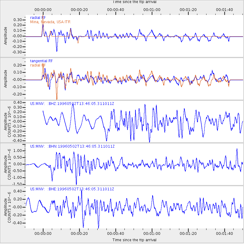
Signal To Noise
| Channel | StoN | STA | LTA |
| US:MNV: :BHN:19960502T13:46:05.311011Z | 1.5410336 | 2.2551129E-7 | 1.4633768E-7 |
| US:MNV: :BHE:19960502T13:46:05.311011Z | 0.7440675 | 8.4155566E-8 | 1.1310206E-7 |
| US:MNV: :BHZ:19960502T13:46:05.311011Z | 0.98722637 | 1.3016117E-7 | 1.3184531E-7 |
| Arrivals |
| Ps | |
| PpPs | |
| PsPs/PpSs | |


