You are here: Home > Network List > US - United States National Seismic Network Stations List
> Station MNV Mina, Nevada, USA > Earthquake Result Viewer
MNV Mina, Nevada, USA - Earthquake Result Viewer
*The percent match for this event was below the threshold and hence no stack was calculated.
| Earthquake location: |
Leeward Islands |
| Earthquake latitude/longitude: |
16.6/-59.6 |
| Earthquake time(UTC): |
1995/03/08 (067) 03:45:59 GMT |
| Earthquake Depth: |
15 km |
| Earthquake Magnitude: |
6.3 MB, 6.2 MS, 6.4 UNKNOWN, 6.1 MD |
| Earthquake Catalog/Contributor: |
WHDF/NEIC |
|
| Network: |
US United States National Seismic Network |
| Station: |
MNV Mina, Nevada, USA |
| Lat/Lon: |
38.43 N/118.15 W |
| Elevation: |
1524 m |
|
| Distance: |
55.4 deg |
| Az: |
305.483 deg |
| Baz: |
96.075 deg |
| Ray Param: |
$rayparam |
*The percent match for this event was below the threshold and hence was not used in the summary stack. |
|
| Radial Match: |
79.47306 % |
| Radial Bump: |
326 |
| Transverse Match: |
80.194435 % |
| Transverse Bump: |
400 |
| SOD ConfigId: |
4480 |
| Insert Time: |
2010-03-05 06:50:39.609 +0000 |
| GWidth: |
2.5 |
| Max Bumps: |
400 |
| Tol: |
0.001 |
|
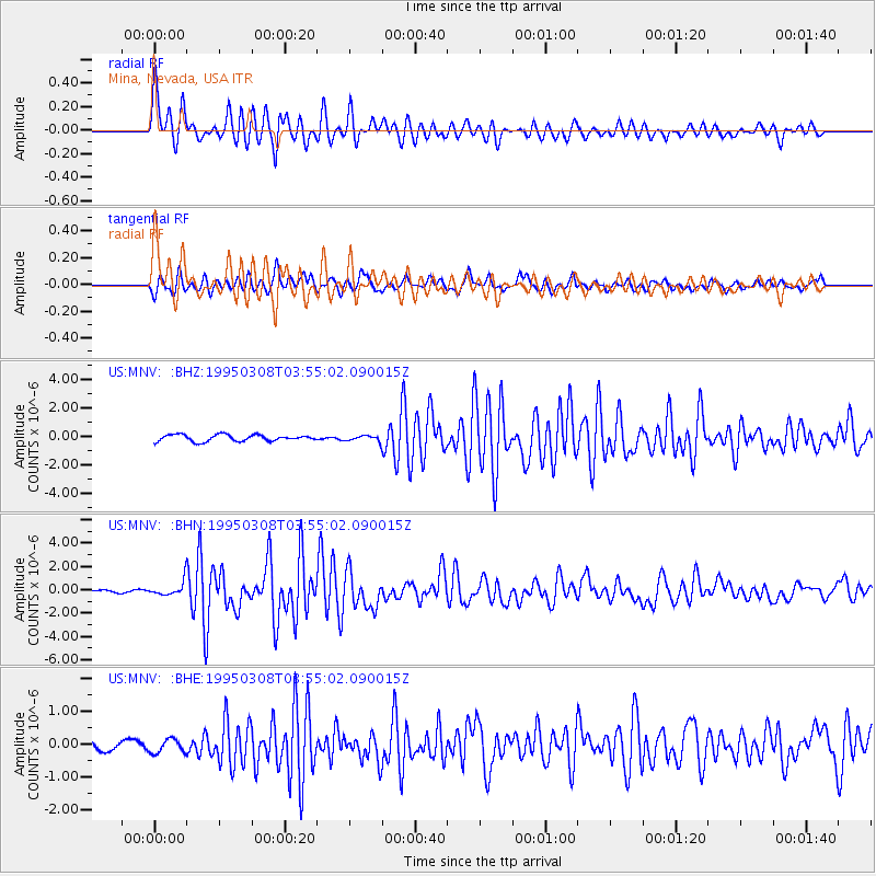
Signal To Noise
| Channel | StoN | STA | LTA |
| US:MNV: :BHN:19950308T03:55:02.090015Z | 3.2683034 | 6.0555163E-7 | 1.8528011E-7 |
| US:MNV: :BHE:19950308T03:55:02.090015Z | 0.9239133 | 2.1286053E-7 | 2.3039016E-7 |
| US:MNV: :BHZ:19950308T03:55:02.090015Z | 0.88600045 | 1.9873907E-7 | 2.2431036E-7 |
| Arrivals |
| Ps | |
| PpPs | |
| PsPs/PpSs | |


