You are here: Home > Network List > US - United States National Seismic Network Stations List
> Station MNV Mina, Nevada, USA > Earthquake Result Viewer
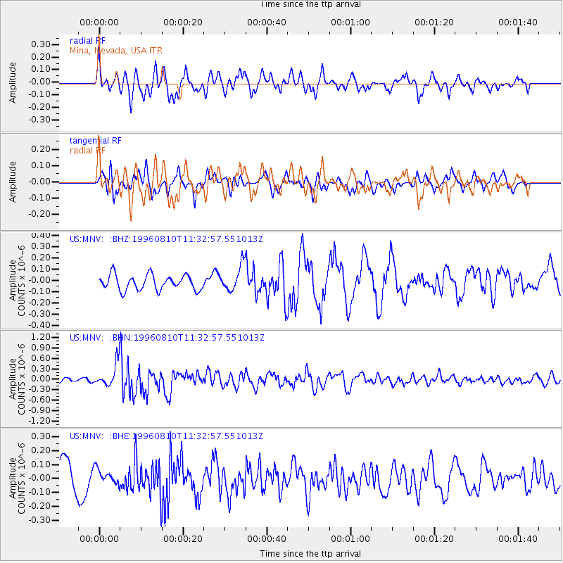
MNV Mina, Nevada, USA - Earthquake Result Viewer
*The percent match for this event was below the threshold and hence no stack was calculated.
| Earthquake location: |
New Britain Region, P.N.G. |
| Earthquake latitude/longitude: |
-4.9/152.1 |
| Earthquake time(UTC): |
1996/08/10 (223) 11:20:19 GMT |
| Earthquake Depth: |
33 km |
| Earthquake Magnitude: |
5.6 MB, 6.0 MS, 6.2 UNKNOWN, 6.1 MW |
| Earthquake Catalog/Contributor: |
WHDF/NEIC |
|
| Network: |
US United States National Seismic Network |
| Station: |
MNV Mina, Nevada, USA |
| Lat/Lon: |
38.43 N/118.15 W |
| Elevation: |
1524 m |
|
| Distance: |
92.8 deg |
| Az: |
51.841 deg |
| Baz: |
265.969 deg |
| Ray Param: |
$rayparam |
*The percent match for this event was below the threshold and hence was not used in the summary stack. |
|
| Radial Match: |
66.304375 % |
| Radial Bump: |
400 |
| Transverse Match: |
63.08051 % |
| Transverse Bump: |
400 |
| SOD ConfigId: |
4480 |
| Insert Time: |
2010-03-05 06:50:44.695 +0000 |
| GWidth: |
2.5 |
| Max Bumps: |
400 |
| Tol: |
0.001 |
|
Signal To Noise
| Channel | StoN | STA | LTA |
| US:MNV: :BHN:19960810T11:32:57.551013Z | 4.994826 | 3.44437E-7 | 6.895876E-8 |
| US:MNV: :BHE:19960810T11:32:57.551013Z | 0.46924543 | 4.7086754E-8 | 1.0034569E-7 |
| US:MNV: :BHZ:19960810T11:32:57.551013Z | 1.7667961 | 1.189122E-7 | 6.7303866E-8 |
| Arrivals |
| Ps | |
| PpPs | |
| PsPs/PpSs | |


