You are here: Home > Network List > US - United States National Seismic Network Stations List
> Station MNV Mina, Nevada, USA > Earthquake Result Viewer
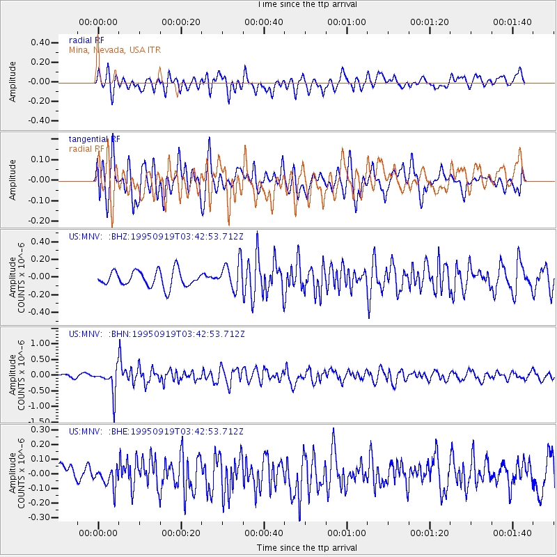
MNV Mina, Nevada, USA - Earthquake Result Viewer
*The percent match for this event was below the threshold and hence no stack was calculated.
| Earthquake location: |
Chile-Bolivia Border Region |
| Earthquake latitude/longitude: |
-21.2/-68.7 |
| Earthquake time(UTC): |
1995/09/19 (262) 03:31:53 GMT |
| Earthquake Depth: |
110 km |
| Earthquake Magnitude: |
5.7 MB, 5.7 UNKNOWN, 5.6 MW |
| Earthquake Catalog/Contributor: |
WHDF/NEIC |
|
| Network: |
US United States National Seismic Network |
| Station: |
MNV Mina, Nevada, USA |
| Lat/Lon: |
38.43 N/118.15 W |
| Elevation: |
1524 m |
|
| Distance: |
75.3 deg |
| Az: |
321.93 deg |
| Baz: |
132.903 deg |
| Ray Param: |
$rayparam |
*The percent match for this event was below the threshold and hence was not used in the summary stack. |
|
| Radial Match: |
48.971455 % |
| Radial Bump: |
400 |
| Transverse Match: |
68.98679 % |
| Transverse Bump: |
400 |
| SOD ConfigId: |
4480 |
| Insert Time: |
2010-03-05 06:50:51.944 +0000 |
| GWidth: |
2.5 |
| Max Bumps: |
400 |
| Tol: |
0.001 |
|
Signal To Noise
| Channel | StoN | STA | LTA |
| US:MNV: :BHN:19950919T03:42:53.712Z | 5.0216074 | 4.167341E-7 | 8.2988194E-8 |
| US:MNV: :BHE:19950919T03:42:53.712Z | 0.87411386 | 6.579044E-8 | 7.52653E-8 |
| US:MNV: :BHZ:19950919T03:42:53.712Z | 1.8147408 | 1.6228931E-7 | 8.942837E-8 |
| Arrivals |
| Ps | |
| PpPs | |
| PsPs/PpSs | |


