You are here: Home > Network List > TA - USArray Transportable Network (new EarthScope stations) Stations List
> Station D23K Nanushuk River, AK USA > Earthquake Result Viewer
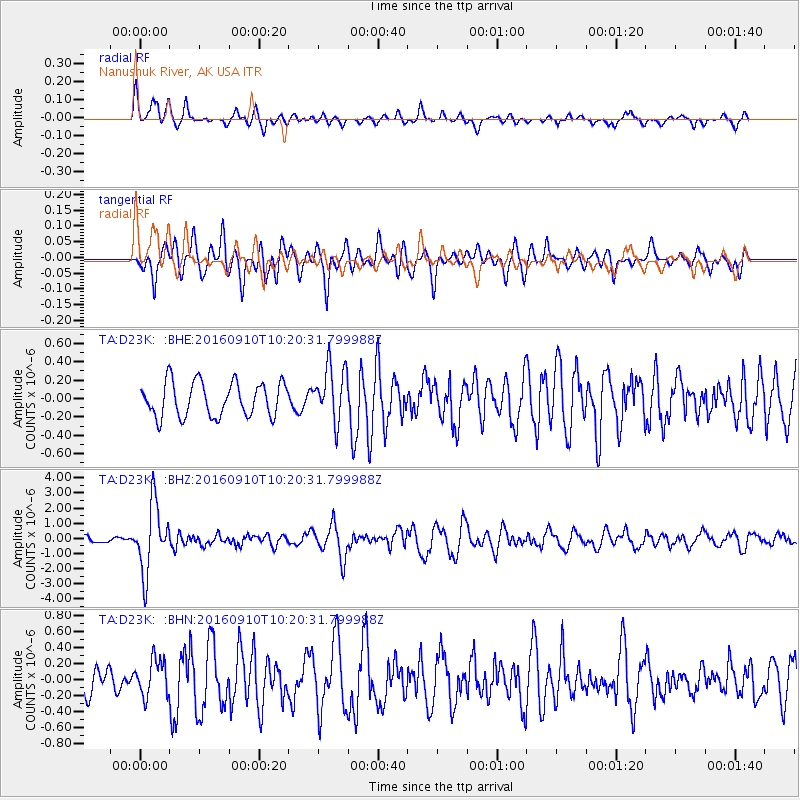
D23K Nanushuk River, AK USA - Earthquake Result Viewer
*The percent match for this event was below the threshold and hence no stack was calculated.
| Earthquake location: |
Northern Peru |
| Earthquake latitude/longitude: |
-5.6/-77.0 |
| Earthquake time(UTC): |
2016/09/10 (254) 10:08:20 GMT |
| Earthquake Depth: |
114 km |
| Earthquake Magnitude: |
6.0 MB |
| Earthquake Catalog/Contributor: |
NEIC PDE/NEIC ALERT |
|
| Network: |
TA USArray Transportable Network (new EarthScope stations) |
| Station: |
D23K Nanushuk River, AK USA |
| Lat/Lon: |
68.97 N/150.68 W |
| Elevation: |
406 m |
|
| Distance: |
89.4 deg |
| Az: |
339.722 deg |
| Baz: |
107.168 deg |
| Ray Param: |
$rayparam |
*The percent match for this event was below the threshold and hence was not used in the summary stack. |
|
| Radial Match: |
72.17498 % |
| Radial Bump: |
400 |
| Transverse Match: |
74.40276 % |
| Transverse Bump: |
400 |
| SOD ConfigId: |
11737051 |
| Insert Time: |
2019-04-25 12:03:14.881 +0000 |
| GWidth: |
2.5 |
| Max Bumps: |
400 |
| Tol: |
0.001 |
|
Signal To Noise
| Channel | StoN | STA | LTA |
| TA:D23K: :BHZ:20160910T10:20:31.799988Z | 8.341923 | 2.2314034E-6 | 2.6749268E-7 |
| TA:D23K: :BHN:20160910T10:20:31.799988Z | 1.9456835 | 2.3204656E-7 | 1.1926222E-7 |
| TA:D23K: :BHE:20160910T10:20:31.799988Z | 1.7124552 | 3.1735703E-7 | 1.8532282E-7 |
| Arrivals |
| Ps | |
| PpPs | |
| PsPs/PpSs | |


