You are here: Home > Network List > IU - Global Seismograph Network (GSN - IRIS/USGS) Stations List
> Station PMG Port Moresby, New Guinea > Earthquake Result Viewer
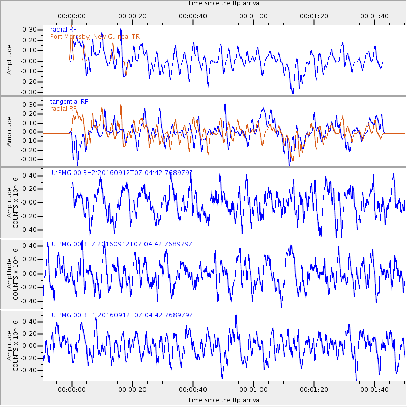
PMG Port Moresby, New Guinea - Earthquake Result Viewer
*The percent match for this event was below the threshold and hence no stack was calculated.
| Earthquake location: |
Easter Island Region |
| Earthquake latitude/longitude: |
-28.8/-112.3 |
| Earthquake time(UTC): |
2016/09/12 (256) 06:51:53 GMT |
| Earthquake Depth: |
10 km |
| Earthquake Magnitude: |
5.8 mww |
| Earthquake Catalog/Contributor: |
NEIC PDE/us |
|
| Network: |
IU Global Seismograph Network (GSN - IRIS/USGS) |
| Station: |
PMG Port Moresby, New Guinea |
| Lat/Lon: |
9.40 S/147.16 E |
| Elevation: |
90 m |
|
| Distance: |
94.6 deg |
| Az: |
256.724 deg |
| Baz: |
119.995 deg |
| Ray Param: |
$rayparam |
*The percent match for this event was below the threshold and hence was not used in the summary stack. |
|
| Radial Match: |
56.450745 % |
| Radial Bump: |
400 |
| Transverse Match: |
35.133316 % |
| Transverse Bump: |
400 |
| SOD ConfigId: |
11737051 |
| Insert Time: |
2019-04-25 12:16:17.722 +0000 |
| GWidth: |
2.5 |
| Max Bumps: |
400 |
| Tol: |
0.001 |
|
Signal To Noise
| Channel | StoN | STA | LTA |
| IU:PMG:00:BHZ:20160912T07:04:42.768979Z | 1.0392053 | 1.9987161E-7 | 1.9233119E-7 |
| IU:PMG:00:BH1:20160912T07:04:42.768979Z | 1.0135093 | 2.7466785E-7 | 2.7100674E-7 |
| IU:PMG:00:BH2:20160912T07:04:42.768979Z | 0.9251399 | 1.7557929E-7 | 1.8978675E-7 |
| Arrivals |
| Ps | |
| PpPs | |
| PsPs/PpSs | |


