You are here: Home > Network List > IU - Global Seismograph Network (GSN - IRIS/USGS) Stations List
> Station XMAS Kiritimati Island, Republic of Kiribati > Earthquake Result Viewer
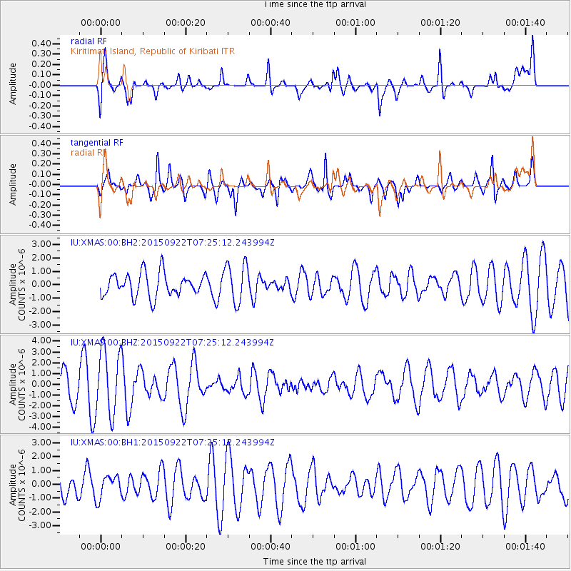
XMAS Kiritimati Island, Republic of Kiribati - Earthquake Result Viewer
*The percent match for this event was below the threshold and hence no stack was calculated.
| Earthquake location: |
Near Coast Of Central Chile |
| Earthquake latitude/longitude: |
-31.5/-71.2 |
| Earthquake time(UTC): |
2015/09/22 (265) 07:12:59 GMT |
| Earthquake Depth: |
54 km |
| Earthquake Magnitude: |
6.1 MWB |
| Earthquake Catalog/Contributor: |
NEIC PDE/NEIC COMCAT |
|
| Network: |
IU Global Seismograph Network (GSN - IRIS/USGS) |
| Station: |
XMAS Kiritimati Island, Republic of Kiribati |
| Lat/Lon: |
2.04 N/157.45 W |
| Elevation: |
20 m |
|
| Distance: |
87.9 deg |
| Az: |
273.686 deg |
| Baz: |
121.443 deg |
| Ray Param: |
$rayparam |
*The percent match for this event was below the threshold and hence was not used in the summary stack. |
|
| Radial Match: |
69.28597 % |
| Radial Bump: |
400 |
| Transverse Match: |
66.405396 % |
| Transverse Bump: |
400 |
| SOD ConfigId: |
1156111 |
| Insert Time: |
2015-10-06 07:48:51.802 +0000 |
| GWidth: |
2.5 |
| Max Bumps: |
400 |
| Tol: |
0.001 |
|
Signal To Noise
| Channel | StoN | STA | LTA |
| IU:XMAS:00:BHZ:20150922T07:25:12.243994Z | 2.764726 | 3.0098506E-6 | 1.0886614E-6 |
| IU:XMAS:00:BH1:20150922T07:25:12.243994Z | 0.6177832 | 8.095772E-7 | 1.3104553E-6 |
| IU:XMAS:00:BH2:20150922T07:25:12.243994Z | 1.7268622 | 1.4828163E-6 | 8.5867663E-7 |
| Arrivals |
| Ps | |
| PpPs | |
| PsPs/PpSs | |


