You are here: Home > Network List > US - United States National Seismic Network Stations List
> Station WMOK Wichita Mountains, Oklahoma, USA > Earthquake Result Viewer
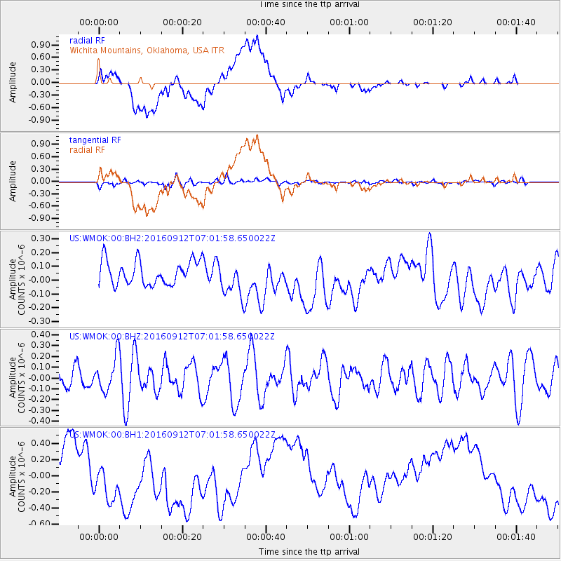
WMOK Wichita Mountains, Oklahoma, USA - Earthquake Result Viewer
*The percent match for this event was below the threshold and hence no stack was calculated.
| Earthquake location: |
Easter Island Region |
| Earthquake latitude/longitude: |
-28.8/-112.3 |
| Earthquake time(UTC): |
2016/09/12 (256) 06:51:53 GMT |
| Earthquake Depth: |
10 km |
| Earthquake Magnitude: |
5.8 mww |
| Earthquake Catalog/Contributor: |
NEIC PDE/us |
|
| Network: |
US United States National Seismic Network |
| Station: |
WMOK Wichita Mountains, Oklahoma, USA |
| Lat/Lon: |
34.74 N/98.78 W |
| Elevation: |
486 m |
|
| Distance: |
64.4 deg |
| Az: |
12.328 deg |
| Baz: |
193.157 deg |
| Ray Param: |
$rayparam |
*The percent match for this event was below the threshold and hence was not used in the summary stack. |
|
| Radial Match: |
21.816637 % |
| Radial Bump: |
400 |
| Transverse Match: |
40.207184 % |
| Transverse Bump: |
400 |
| SOD ConfigId: |
11737051 |
| Insert Time: |
2019-04-25 12:20:33.748 +0000 |
| GWidth: |
2.5 |
| Max Bumps: |
400 |
| Tol: |
0.001 |
|
Signal To Noise
| Channel | StoN | STA | LTA |
| US:WMOK:00:BHZ:20160912T07:01:58.650022Z | 1.930817 | 1.6737228E-7 | 8.668469E-8 |
| US:WMOK:00:BH1:20160912T07:01:58.650022Z | 1.8517544 | 3.5769264E-7 | 1.9316418E-7 |
| US:WMOK:00:BH2:20160912T07:01:58.650022Z | 1.5477324 | 1.3373659E-7 | 8.6408086E-8 |
| Arrivals |
| Ps | |
| PpPs | |
| PsPs/PpSs | |


