You are here: Home > Network List > UW - Pacific Northwest Regional Seismic Network Stations List
> Station LTY Liberty (broad-band) > Earthquake Result Viewer
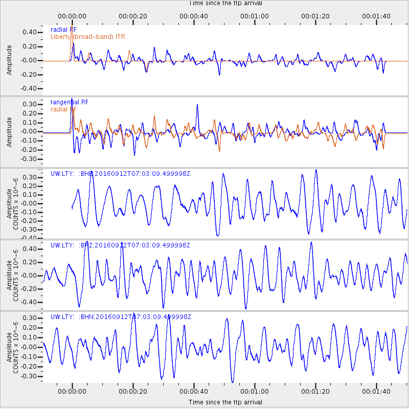
LTY Liberty (broad-band) - Earthquake Result Viewer
*The percent match for this event was below the threshold and hence no stack was calculated.
| Earthquake location: |
Easter Island Region |
| Earthquake latitude/longitude: |
-28.8/-112.3 |
| Earthquake time(UTC): |
2016/09/12 (256) 06:51:53 GMT |
| Earthquake Depth: |
10 km |
| Earthquake Magnitude: |
5.8 mww |
| Earthquake Catalog/Contributor: |
NEIC PDE/us |
|
| Network: |
UW Pacific Northwest Regional Seismic Network |
| Station: |
LTY Liberty (broad-band) |
| Lat/Lon: |
47.26 N/120.66 W |
| Elevation: |
970 m |
|
| Distance: |
76.0 deg |
| Az: |
354.143 deg |
| Baz: |
172.441 deg |
| Ray Param: |
$rayparam |
*The percent match for this event was below the threshold and hence was not used in the summary stack. |
|
| Radial Match: |
49.616074 % |
| Radial Bump: |
400 |
| Transverse Match: |
53.786842 % |
| Transverse Bump: |
400 |
| SOD ConfigId: |
11737051 |
| Insert Time: |
2019-04-25 12:20:56.219 +0000 |
| GWidth: |
2.5 |
| Max Bumps: |
400 |
| Tol: |
0.001 |
|
Signal To Noise
| Channel | StoN | STA | LTA |
| UW:LTY: :BHZ:20160912T07:03:09.499998Z | 3.4029303 | 2.787226E-7 | 8.190665E-8 |
| UW:LTY: :BHN:20160912T07:03:09.499998Z | 0.922809 | 9.1449444E-8 | 9.909899E-8 |
| UW:LTY: :BHE:20160912T07:03:09.499998Z | 1.1632297 | 1.6685527E-7 | 1.4344137E-7 |
| Arrivals |
| Ps | |
| PpPs | |
| PsPs/PpSs | |


