You are here: Home > Network List > TA - USArray Transportable Network (new EarthScope stations) Stations List
> Station G21K Allakaket, AK, USA > Earthquake Result Viewer
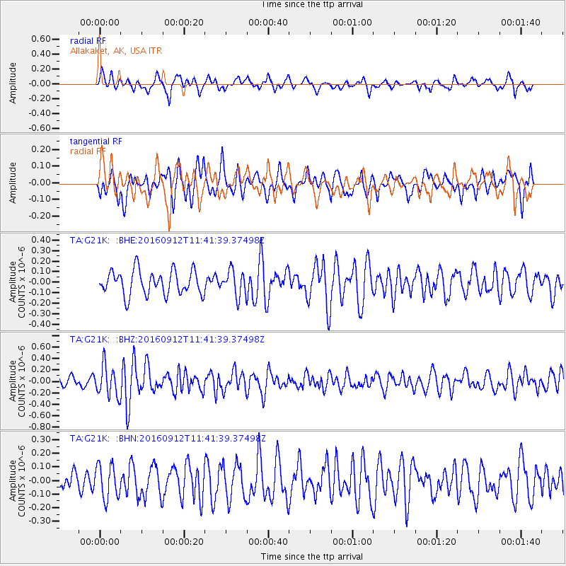
G21K Allakaket, AK, USA - Earthquake Result Viewer
*The percent match for this event was below the threshold and hence no stack was calculated.
| Earthquake location: |
South Korea |
| Earthquake latitude/longitude: |
35.8/129.2 |
| Earthquake time(UTC): |
2016/09/12 (256) 11:32:55 GMT |
| Earthquake Depth: |
13 km |
| Earthquake Magnitude: |
5.4 Mww |
| Earthquake Catalog/Contributor: |
NEIC PDE/us |
|
| Network: |
TA USArray Transportable Network (new EarthScope stations) |
| Station: |
G21K Allakaket, AK, USA |
| Lat/Lon: |
66.52 N/153.51 W |
| Elevation: |
446 m |
|
| Distance: |
52.8 deg |
| Az: |
29.406 deg |
| Baz: |
274.988 deg |
| Ray Param: |
$rayparam |
*The percent match for this event was below the threshold and hence was not used in the summary stack. |
|
| Radial Match: |
49.377975 % |
| Radial Bump: |
380 |
| Transverse Match: |
53.9433 % |
| Transverse Bump: |
400 |
| SOD ConfigId: |
11737051 |
| Insert Time: |
2019-04-25 12:29:56.094 +0000 |
| GWidth: |
2.5 |
| Max Bumps: |
400 |
| Tol: |
0.001 |
|
Signal To Noise
| Channel | StoN | STA | LTA |
| TA:G21K: :BHZ:20160912T11:41:39.37498Z | 3.2884595 | 2.745018E-7 | 8.347428E-8 |
| TA:G21K: :BHN:20160912T11:41:39.37498Z | 1.6628263 | 1.255261E-7 | 7.54896E-8 |
| TA:G21K: :BHE:20160912T11:41:39.37498Z | 1.0875102 | 1.2508612E-7 | 1.1502063E-7 |
| Arrivals |
| Ps | |
| PpPs | |
| PsPs/PpSs | |


