You are here: Home > Network List > TA - USArray Transportable Network (new EarthScope stations) Stations List
> Station J20K Nowitna River, AK, USA > Earthquake Result Viewer
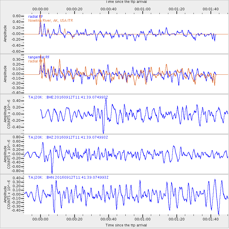
J20K Nowitna River, AK, USA - Earthquake Result Viewer
*The percent match for this event was below the threshold and hence no stack was calculated.
| Earthquake location: |
South Korea |
| Earthquake latitude/longitude: |
35.8/129.2 |
| Earthquake time(UTC): |
2016/09/12 (256) 11:32:55 GMT |
| Earthquake Depth: |
13 km |
| Earthquake Magnitude: |
5.4 Mww |
| Earthquake Catalog/Contributor: |
NEIC PDE/us |
|
| Network: |
TA USArray Transportable Network (new EarthScope stations) |
| Station: |
J20K Nowitna River, AK, USA |
| Lat/Lon: |
64.18 N/154.15 W |
| Elevation: |
314 m |
|
| Distance: |
52.7 deg |
| Az: |
32.376 deg |
| Baz: |
276.204 deg |
| Ray Param: |
$rayparam |
*The percent match for this event was below the threshold and hence was not used in the summary stack. |
|
| Radial Match: |
54.98028 % |
| Radial Bump: |
400 |
| Transverse Match: |
49.441414 % |
| Transverse Bump: |
352 |
| SOD ConfigId: |
11737051 |
| Insert Time: |
2019-04-25 12:30:04.960 +0000 |
| GWidth: |
2.5 |
| Max Bumps: |
400 |
| Tol: |
0.001 |
|
Signal To Noise
| Channel | StoN | STA | LTA |
| TA:J20K: :BHZ:20160912T11:41:39.074993Z | 3.3469152 | 2.5761824E-7 | 7.6971844E-8 |
| TA:J20K: :BHN:20160912T11:41:39.074993Z | 0.801073 | 9.306138E-8 | 1.1617091E-7 |
| TA:J20K: :BHE:20160912T11:41:39.074993Z | 0.9846621 | 1.17383564E-7 | 1.1921202E-7 |
| Arrivals |
| Ps | |
| PpPs | |
| PsPs/PpSs | |


