You are here: Home > Network List > TA - USArray Transportable Network (new EarthScope stations) Stations List
> Station R11A Troy Canyon, Currant, NV, USA > Earthquake Result Viewer
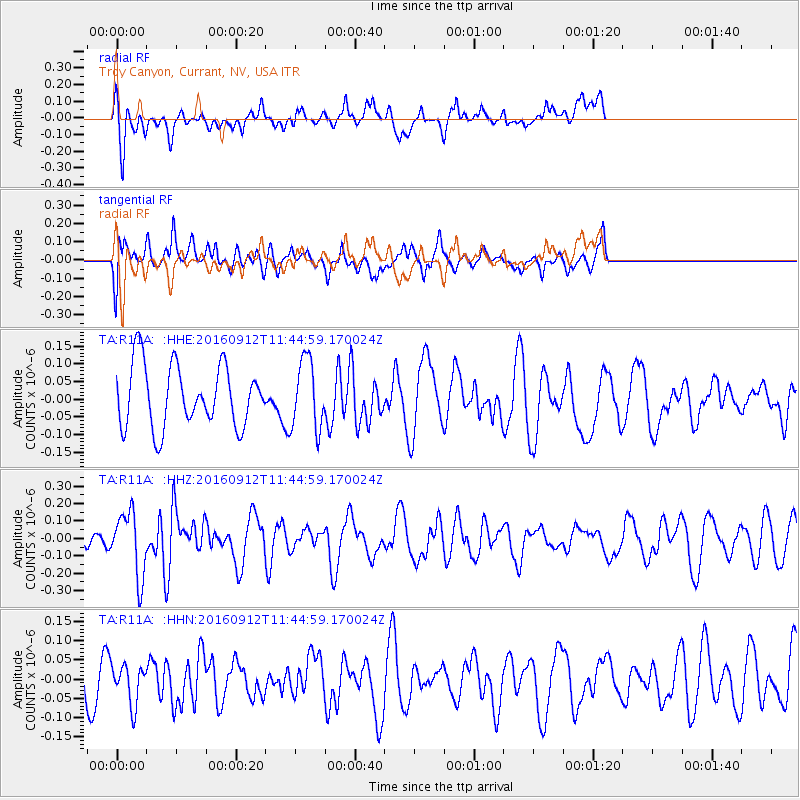
R11A Troy Canyon, Currant, NV, USA - Earthquake Result Viewer
*The percent match for this event was below the threshold and hence no stack was calculated.
| Earthquake location: |
South Korea |
| Earthquake latitude/longitude: |
35.8/129.2 |
| Earthquake time(UTC): |
2016/09/12 (256) 11:32:55 GMT |
| Earthquake Depth: |
13 km |
| Earthquake Magnitude: |
5.4 Mww |
| Earthquake Catalog/Contributor: |
NEIC PDE/us |
|
| Network: |
TA USArray Transportable Network (new EarthScope stations) |
| Station: |
R11A Troy Canyon, Currant, NV, USA |
| Lat/Lon: |
38.35 N/115.59 W |
| Elevation: |
1756 m |
|
| Distance: |
85.0 deg |
| Az: |
45.576 deg |
| Baz: |
312.39 deg |
| Ray Param: |
$rayparam |
*The percent match for this event was below the threshold and hence was not used in the summary stack. |
|
| Radial Match: |
43.427845 % |
| Radial Bump: |
322 |
| Transverse Match: |
62.215767 % |
| Transverse Bump: |
400 |
| SOD ConfigId: |
11737051 |
| Insert Time: |
2019-04-25 12:30:25.093 +0000 |
| GWidth: |
2.5 |
| Max Bumps: |
400 |
| Tol: |
0.001 |
|
Signal To Noise
| Channel | StoN | STA | LTA |
| TA:R11A: :HHZ:20160912T11:44:59.170024Z | 3.4227219 | 1.8511841E-7 | 5.408515E-8 |
| TA:R11A: :HHN:20160912T11:44:59.170024Z | 1.1685768 | 5.0896247E-8 | 4.3554042E-8 |
| TA:R11A: :HHE:20160912T11:44:59.170024Z | 1.1304638 | 9.8681134E-8 | 8.7292605E-8 |
| Arrivals |
| Ps | |
| PpPs | |
| PsPs/PpSs | |


